16th Street’s traffic lights are now optimized for buses
While planning for a 16th Street bus lane continues, DDOT has quietly made another important but nearly invisible improvement there: The traffic signals are now optimized for buses.
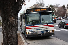
16th and U queue jump signal. Photo by the author.
33 traffic signals along 16th Street now have Transit Signal Priority, or TSP. TSP holds a green light a few seconds longer, or switches a red to green a few seconds sooner, if a bus is ready to pass through.
Stopping at fewer red lights speeds buses along a line. In particular, DC is using TSP on 16th Street to keep S9 buses on schedule. When one falls behind, the signal priority kicks in so that bus can catch up.
16th Street has so many buses that DDOT can’t give each one priority all the time, or it would gum up every perpendicular street along the line. But keeping buses on schedule is a nice improvement for riders.
16th & U queue jumper
In addition to TSP, at 16th and U there’s now a dedicated signal just for buses, called a queue jumper. It gives buses their own “go” signal a few seconds before cars get their green, allowing buses to jump ahead of a line of waiting cars. By the time cars get their green and start moving forward, the bus is in front of them rather than behind.
The bus signal looks different than a normal light, so car drivers don’t mistake it for one they’re supposed to follow. A horizontal bar means stop, and a vertical bar mean go. It’s the same as the dedicated streetcar signal at 3rd and H, and the same as bus signals along the Crystal City Potomac Yard transitway.
Traffic lights may not be as exciting as bus lanes, but these details matter. Thanks DDOT for making this progress.
Why we don’t have world class BRT in the US, explained with one picture
Bus rapid transit lines in the United States badly lag the world’s most high-quality systems. This photo from Buenos Aires shows why: No US city is willing to dedicate so much street space to buses.
Buenos Aires BRT. Photo by exploreadorurbano on Instagram.
Count the lanes dedicated to the busway in that picture. Including the stations, medians, and bus lanes, it totals about eight lanes worth of traffic.
It takes that kind of dedication to fulfill BRT’s promise of subway-like service and capacity. You need all the components: Multiple bus lanes including passing lanes, big stations physically separated from the sidewalk, unmistakable barriers between the busway and general traffic.
Can you imagine any US city dedicating eight lanes to buses on a single street? On most streets we couldn’t do it even if we wanted to. K Street is 10 lanes wide including its medians, but Georgia Avenue and H Street are generally only six. 16th Street is five lanes at the max. Even if we completely banned cars from those streets, we’d lack the width to build Buenos Aires-style BRT.
Admittedly, Buenos Aires is an extreme example. This photo is from Avenida 9 de Julio, possibly the world’s widest city street. Planners there had an incredible amount of space to work with. Bogota’s famous TransMilenio BRT is probably a more instructive example; it takes more than five lanes.
Five lanes is physically possible on many US city streets, including in DC. But physically possible and politically practical are vastly different standards.
We wouldn’t want to anyway
Even if cities in the United States had both the physical space and political will to dedicate five-to-eight lanes to buses, there would be big trade-offs in doing so.
Streets that are too wide or have too-fast-moving traffic are hard for pedestrians to cross, and thus create barriers that can destroy a city’s walkability.
Bogota’s awesome five lane busways are practically highways, accounting for the several lanes of car traffic on either side. And like highways, they’re very good at moving vehicles and very hostile to pedestrians.
About the only way to make such a wide busway work on a city street without creating a highway would be to dedicate the entire street to transit, and not have car lanes on either side at all. Some US cities do have transit-only streets, so that may well be possible. But it would be different than South America’s model.
Arlington’s narrower Crystal City busway.
Smaller busways make sense for the US
None of this is to say that BRT in the United States is hopeless. It’s absolutely possible to build a solid and useful BRT line without quite that much street width. They just won’t be comparable to a subway in speed or capacity without passing lanes and gargantuan stations.
But who says they need to be?
Narrower busways like in Arlington and Ontario still offer tremendous advantages over running buses in mixed traffic. They speed up buses a lot, and are vastly more practical when retrofitting existing streets.
And while it’s true that North American-style busways can never have such high capacity as South American ones, well, that’s what rail is for.
It would be silly to insist one mode, any mode, must on its own accomplish all a city’s needs. Smart planning matches the need to the corridor, and is flexible enough to use the right mode, and the right street design, on every corridor, given the specific issues of that location.
College Park recreated Paris’s “bus stop of the future” on the cheap
Four years ago, Paris made headlines for its bus stop of the future, a bigger and better bus stop with amenities like bikesharing and a book-sharing library attached. Now College Park has a bus stop with some of the same amenities, but using inexpensive, off-the-shelf pieces.
College Park’s bus stop of the future.
Paris’ bus stop of the future
In 2012, Paris’s transit agency tried out a luxurious new bus stop design. In addition to the normal sign, bench, and shelter, the stop had electric bikes, bookshelves, wifi, and stylish architecture. It looked great and it made waiting for the bus more enjoyable, but it was expensive and took up a lot of space.
Paris’s concept was a neat idea, but wasn’t ultimately practical for mass production.
Paris’s bus stop of the future. Image from RATP.
But some of the ideas from Paris’s attempt make sense. Locating a bikeshare station next to a bus stop makes it convenient for more people to use both. And book-sharing can be a nice amenity, if it’s easy and inexpensive to manage.
College Park’s version
Enter College Park, where rather than design a custom building, the city simply added some of those components to an existing bus stop using their standard off-the-shelf pieces.
They started with a normal bus stop sign and shelter, then added a standard mBike bikeshare station. To help with maintenance, the city chained a bike tire pump to the station sign.
For the library, they staked to the ground a Little Free Library, a pre-fab wood box for people to take and give away free books. There’s no librarian and no library cards; it runs on the honor system, and relies on people donating as many books as they take.
A similar Little Free Library in California. Photo by Michael R Perry on Flickr.
The stop is at the corner of Rhode Island Avenue and Muskogee Street, in front of the Hollywood shopping center, just one block south of College Park’s first protected bikeway. The stop serves Metrobus lines 81 and 83, which are among the busier lines in Prince George’s County.
It’s no grand Parisian bus station, but that would be overkill. For a bus stop in a relatively low-density suburban area, it’s pretty darn nice.
DC’s first bright red bus lanes now adorn four blocks of Georgia Avenue, near Howard University. DDOT crews added the red surface earlier this month.
Georgia Avenue’s new red carpet for buses.
The bus lanes run along both curbs, from Florida Avenue north to Barry Place. They speed Metrobus’ busy 70-series line through what was the slowest section of Georgia Avenue north of downtown.
The bright red color is a strong visual clue to car drivers to stay out of the lane. It’s a stark contrast to the Gallery Place bus lane a dozen blocks south, which is so poorly marked that many car drivers legitimately don’t know it’s there. For these four blocks, drivers will have no excuse.
Anecdotally, the red surface seems to be working pretty well. Most car drivers seem to stay out. To find out for sure, DDOT is in the process of collecting actual data, comparing the car violation rate now to the rate from before the red surface was added.
Nitty gritty
Cyclists and taxicabs are allowed the use the lanes in addition to buses. Signs along the street spell out the exact rules.
Since the lanes are along the curb, cars can enter them to turn right. Dashed white lane markings show where cars can enter.
To avoid wear-and-tear and to make the bus lanes safer for cyclists, the “red paint” is actually a gritty surface coating. If you walk along Georgia Avenue now, you can still see some of the leftover grit along the curb.
❤ the transit red carpet
By adding these lanes and marking them clearly, DC is taking an real step towards prioritizing street space for transit. At only four blocks long they’re are a humble start, but a start nonetheless.
The “red carpet” is an increasingly common part of the street design toolbox in New York, Chicago, San Francisco, and Seattle. It’s great that DC is getting on board too.
With more transit lanes in the works for K Street, H Street, and 16th Street, this humble start will hopefully soon become a trend. A red surface would probably help them all.
Metroway runs between Pentagon City and Braddock Road Metro stations. For much of its route, between Crystal City and Potomac Yard, it runs in dedicated bus lanes, making it the Washington region’s first real foray into BRT.
The Alexandria portion of the transitway opened in 2014. Arlington’s portion through Crystal City opened yesterday, Sunday, April 17.
Through Potomac Yard, the transitway runs in a totally exclusive busway—a completely separate road from the regular lanes.
27th & Crystal station.
Stations in the busway have substantial arched roofs and attractive wall panels.
South Glebe station.
Through Crystal City, bus lanes and bus stations hug the curb.
18th & Crystal station.
Since northbound buses run a block away from southbound buses, bus stations are smaller through this section. More like large bus stops.
23rd & Clark station.
Crystal City is pretty quiet on Sundays, so there weren’t many opening day riders and buses only came every 20 minutes. During the week there’ll be a lot more riders, and buses will run every 6-12 minutes depending on the time of day.
Head over to Crystal City and check it out! Or see more pictures of both the Arlington and Alexandria transitway sections via Flickr.
April is going to be a huge month for bus lanes. On Monday, April 11, DC will open a four block stretch on Georgia Avenue. Then on Sunday, April 17, Arlington will open the Crystal City transitway.
Crystal City transitway station. Photo by Arlington.
Georgia Avenue
Georgia Avenue’s bus lanes will run just four blocks, from Florida Avenue to Barry Place. They’ll be curbside lanes, with normal bus stops on the sidewalk.
Location of Georgia Avenue bus lanes. Image from DC and Google.
Four blocks is short, but this location is specifically one of the slowest stretches WMATA’s busy 70-series bus line passes through. Bus lanes here will speed the entire line.
Just as importantly, this will be a test project for DDOT to study, and to learn about bus lane implementation. In May, crews will add red paint to the roadway to make the bus lanes more visually obvious. By adding the red surface later, DDOT will gather data on whether the red really does dissuade car drivers from using the lanes illegally.
Red-painted curbside bus lane in New York. Photo by NACTO.
If Georgia Avenue’s four block bus lanes prove successful, they could provide a model for the citywide transit lane network envisioned in moveDC. They could also one day form the backbone of a future Georgia Avenue streetcar.
They’re short, but they’re important.
Crystal City
Get ready for bona fide BRT.
On Sunday the 17th, Arlington will open the second half of the Crystal City Potomac Yard Transitway, better known as Metroway. The first half opened in 2014 in Alexandria, and was the Washington region’s first foray into BRT.
The new Crystal City transitway section will run from Crystal City Metro south to Alexandria, where it will join the existing busway. It’ll be a mix of curbside bus lanes and fully exclusive bi-directional busway.
Crystal City transitway. Image by Arlington.
The DC region once had 60 miles of bus-only lanes. With these projects finally happening, and others like 16th Street on the horizon, it’s exciting to see a reborn network begin to take shape.
Rockville misses the forest for the trees with its plan for an 18-lane mega main street
Rockville Pike could one day become a 252-foot-wide mega boulevard with 12 car lanes, 4 bike lanes, 2 bus lanes, and over 50 feet of landscaping. But in designing a street with more than ample room for cars, bikes, and buses, planners abandon any hope the street will be walkable.
The plan for Rockville Pike. Image from Rockville.
Everybody gets a lane!
Rockville Pike is one the most important retail strip highways in the Washington region. Like most 20th Century retail roads, it’s designed for cars, and it carries a lot of them.
Rockville wants to make it a more urban main street, so planners there are drawing up a redevelopment plan. It’s a laudable goal, and it’s not easy on a high-traffic state highway like Rockville Pike.
At first glance, this plan has all the components of a good complete street design: Tree-lined sidwalks, protected bikeways, a center-running dedicated busway. Every mode gets all the street width it could possibly want.
And why not? Why go through the political headache of forcing the community to make the difficult choice between fewer car lanes versus bikes or BRT if you can fit everything in? With a mega boulevard like this, everybody gets what they want, and nobody loses. Right?
Wrong.
Walkability loses, and it’s the most important factor
At 252 feet wide, the new Rockville Pike will be practically impossible for pedestrians to cross. It will take multiple traffic light cycles and multiple minutes for anyone to cross.
Instead of a main street, Rockville will have a barrier. And that is a big problem for the rest of the plan.
Transit oriented development doesn’t work unless it’s walkable. If Rockville Pike is too wide, development on one side of the street will be effectively cut-off from development on the other side. Riders won’t be able to easily access the BRT stations. People will drive for even short trips. The concept of a community where people don’t need to drive everywhere will break down.
If you can’t walk, other multimodal options don’t work. Pedestrians are the linchpin to the whole thing.
To be sure, some level of compromise is always needed. If walkability were the only factor that mattered, all streets would be pedestrian-only. We add in car lanes, bike lanes, and transit because we have to make longer trips possible, and that’s a good thing.
But there’s a balance, and 252 feet veers so far to accommodate long distance travel that it seriously sacrifices short distance walking. In so doing, Rockville undermines the very foundation on which its redevelopment plans rest.
Make pedestrians a priority
The Pike needs to be narrower. Assuming the sidewalks, busway, and three general car lanes each direction are sacrosanct, that still leaves a lot of potential fat to trim.
Are the service roads really necessary if the plan also includes new parallel local streets? Do we really need redundant bi-direction bikeways next to both sidewalks? Could we possibly reduce the 74 feet of various landscaping, buffer, and turn lanes?
These would be difficult trade-offs, to be sure. But there are massive negative consequences to an uncrossable mega boulevard.
If Rockville wants the new Pike to work as multimodal urban place, pedestrians need to become a priority.
DC recommends a rush-hour bus lane for 16th Street
Photo by truthaboutit on Flickr.
It won’t appear immediately, but DC took a big step toward speeding up buses on 16th Street by recommending a rush-hour bus lane and a package of other ways to make bus service better.
Smaller stations, fewer dedicated lanes for Gaithersburg BRT
As designs for the Corridor Cities Transitway BRT line solidify, officials are revising plans to try and cut costs and ease approvals. Among the changes: Smaller stations, fewer dedicated lanes, and fewer grade-separated street crossings.
>Original two-bus station design (left) and smaller one-bus design (right). All images from Maryland.
Smaller stations
According to initial designs, all transitway stations would have been 150 feet long, large enough to comfortably accommodate two articulated buses in each direction.
The revised plans reduce six of the transitway’s ten stations down to 65 feet long, and the other four stations down to 125 feet.
The 125-foot stations will still be able to squeeze in two buses at a time. The 65-foot stations will only fit a single bus. All stations will be designed so they can expand to 125 feet later if necessary.
With buses scheduled to come every six minutes at peak times, single-bus stations could cause delays if buses begin to bunch together.
Dedicated lanes at the Belward property
The Corridor Cities Transitway will be, for the most part, true BRT. It will have a dedicated running way for most of its length. But now officials are proposing that it run in mixed traffic for a 1.1 mile detour around the Belward property, aka the last farm in Gaithersburg.
Original alignment through the Belward property (left) and proposed mixed-traffic realignment around it (right).
This change isn’t to save money, nor is it to avoid upsetting car drivers. It has to do with the historic farmhouse in the middle of the property.
Under federal rules concerning historic preservation, the state cannot build the transitway through the farm unless the property is disturbed by development first. But Montgomery County’s master plan does not allow for development on the farm until after the transitway is up and running. It’s a chicken and egg problem.
Thus Maryland’s new plan: Buses will detour around Belward farm on existing roads, in mixed traffic.
It’s not clear whether the detour plan is supposed to be temporary or permanent. It could be the state will operate the detour at first, long enough to allow development at Belward, and then retrofit in the dedicated transitway once development is underway.
Or it could be the state will never correct this problem, and buses will run in mixed-traffic around Belward long after buildings have replaced the farm. Time will tell.
At-grade street crossing
Another major cost-saving change is coming where the transitway crosses MD Route 28, Key West Avenue.
Transitway crossing of Key West Avenue.
Initial plans called for an underpass below Key West Avenue. Buses never would have had to stop for a red light. New plans show a surface crossing, meaning buses will have to contend with traffic signals.
And although the state webpage does clearly say that an at-grade crossing will have minimal “effects on general traffic flow through the intersection,” it doesn’t say anything about how this change will affect transit travel time.
Questions about cost
Montgomery County official Glenn Orlin recently revealed that costs for the transitway are climbing.
The most recent state cost estimate, from 2012, was for $545 million. Officially that’s still the estimate. But Orlin says a new estimate is forthcoming and will be “in the $700-800 million range.” If true, that’s a troubling increase, and could explain some of the state’s moves to reduce costs.
On the other hand, Orlin also indicated the new estimate is in year-of-construction dollars, while the old estimate was in 2012 dollars. If so, inflation could account for the lion’s share of the difference. Until the actual estimate comes out, it’s impossible to know.
It may not matter anyway, as the transitway remains unfunded, and prospects for funding under Maryland Governor Hogan appear slim.


 Comment on this at the version cross-posted to Greater Greater Washington.


