


Senator Lindsey Graham (R-SC) says he will vote against the climate bill he helped to write, which dramatically reduces the likelihood that Congress will be able to pass a bill to, y’know, avert global catastrophe. Ain’t partisanship super?
In honor of Mr. Graham’s decision to give the finger to future generations, here are some images from geology.com’s sea level rise mapper. At least we’ll know who gets screwed over the most.
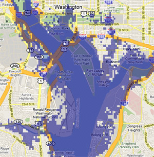
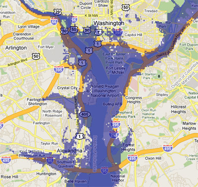
Climate scientists have so far pegged likely sea rise over the next century at somewhere between one and two meters. Here’s what a two meter rise would do to DC:
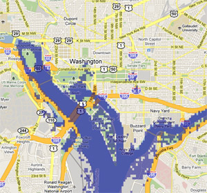
That’s not so bad. East Potomac Park is gone, some Pentagon parking lots go under, and the White House gets a reflecting pool. Hardly worth paying more for gas.
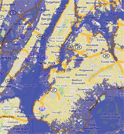
Here’s New York (left) and Ocean City (right):
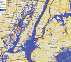
Except for some flooding around the Battery, Manhattan survives. Jersey’s Meadowlands become Meadow Bay, however, and all that’s left of Ocean City is Coastal Highway. Totally the best part.
Now New Orleans and The Netherlands:
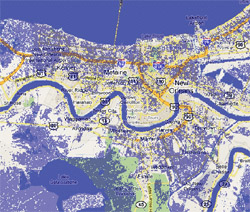
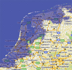
Well, nobody likes them anyway.
But hey, that 2-meters-in-a-century assumption is based on the slow gradual model of climate change. If something big happens, like say the Greenland ice sheet melts, we’re looking at more like a 7 meter rise. Here’s what that does to DC:
Goodbye, Southwest. Maybe we’ll get a water polo team to play in the Nationals stadium.
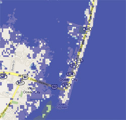
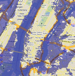
New York and Florida:
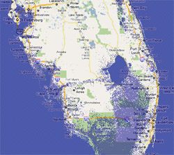
Manhattan loses a few blocks on either side, but the outer boroughs really suffer. Fort Myers and Naples are gone, but it’s kind of cool that Lake Okeechobee is a bay.
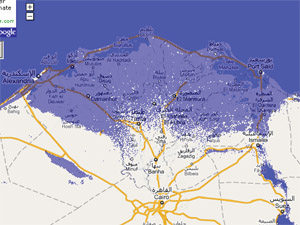
Hopefully you don’t know any of the 40 million people who call the Nile Delta home:
But you know, that’s awfully unrealistic. 7 meters from Greenland? Come on. Everybody knows that if Greenland goes, there’s a good chance West Antarctica could go too. That’s more like 12 meters. Here’s 12 meters of new Potomac:
:shrug: Sorry, Alexandria.
New York and Northern California:
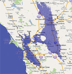
Manhattan’s rapidly losing ground now, and Brooklyn is about as big as Manhattan used to be. Most of the City of San Francisco survives, but all its suburbs are gone and Sacramento is at the bottom of a new sea.
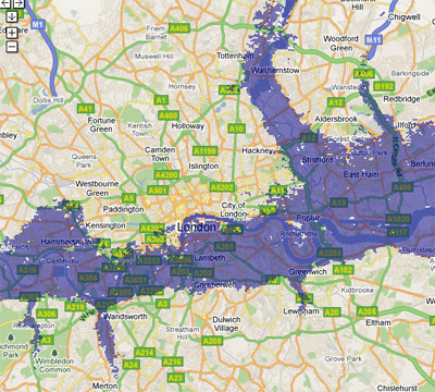
Hope nobody is too attached to central London:
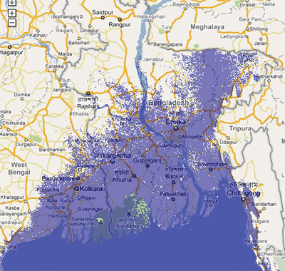
And you know what, if you’re one of the 160 million people in Bangladesh then you have only yourself to blame:
You can recreate all these maps at geology.com. It’s fun! Sort of like disaster mode on SimCity, except it’s the real world!
* Note that if this happens, Denver will be a desert. You wouldn’t want to live there either.
June 8th, 2010 | Permalink
Tags: environment, featured post


