


Arlington’s commercial corridors are so urban and bustling these days that it’s hard to imagine them as suburban strip highways, but until construction of the Metrorail brought a wave of transit oriented development, suburban strips is exactly what they were.
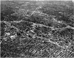
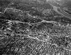
The changes along the corridors (and the stability of the surrounding neighborhoods) are clearly visible thanks to a fascinating set of historic aerial images taken in the 1970s, posted to the new Arlington County planning department flickr page.
Consider these examples, side by side with contemporary aerials taken by M.V. Jantzen, Arlington County planner Andrew D’huyvetter, and myself. Click through for larger versions of each image.
 |
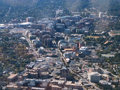 |
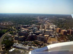
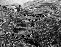
| Ballston, with I-66 under construction | |
 |
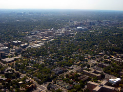 |
| Clarendon | |
 |
 |
| Courthouse | |
 |
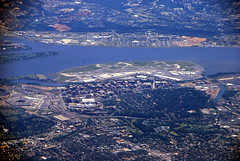 |
| Crystal City | |
 |
 |
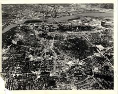
| The Orange line corridor | |
 Cross-posted at Greater Greater Washington.


