


Last in this week’s series of simple DC maps: city topography.
Interesting features that are clearly visible include Capitol Hill, Rock Creek gorge, the Anacostia bluffs, the floodplain escarpment at the north end of the L’Enfant city, the heights of Tenleytown (culminating at Fort Reno for DC’s highest point), and a large hill near the US Soldiers’ Home that I’m sorry to say I can’t name.
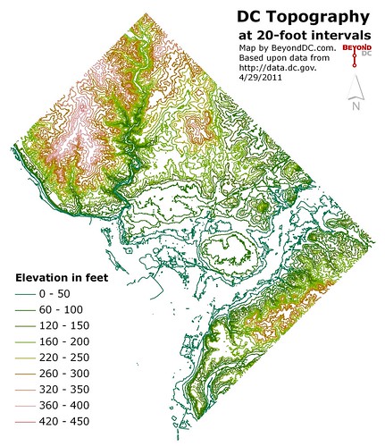
Click the map to enlarge.
April 29th, 2011 | Permalink
Tags: environment, galleries


