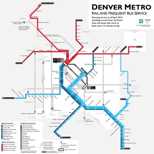
Denver is in the midst of a huge regional rail expansion. That’s great, but like in many cities (including DC, historically), the urban bus system has been largely ignored amidst all the hubbub over rail.
I got my planning degree at the University of Colorado, and after discussing Denver’s bus system with some friends recently, decided to produce this map. It shows the city’s high-frequency bus routes along with its existing and future rail lines.
Although the geography is obviously different, in many ways this map is a sequel to my DC 15-minute bus map from last August. I applied a lot of the lessons learned during that exercise to this Denver map. Compared to the DC version this map shows more information, presented more cleanly.
Read more at DenverUrbanism.com.

Denver rail and frequent bus map, including future lines. Click map for full size version.
Other sizes via flickr.
February 27th, 2013 | Permalink
Tags: BRT, bus, commuterrail, lightrail, maps, streetcar, transportation


