Special Features

Image Libraries

Blog
Lost rivers of Washington

Constitution Avenue used to be a canal, and two creeks used to flow through central DC. David Ramos produced a series of maps showing where they went.

Imagine what a different city Washington might be today if these had been kept in place.


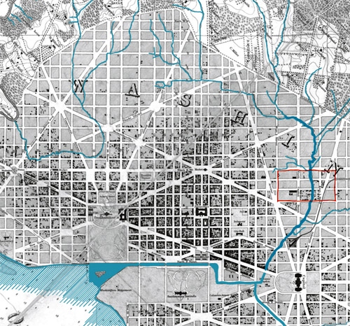
Image from David Ramos on ImaginaryTerrain.com.

June 3rd, 2013 | Permalink
Tags: environment, maps


Media


Site
About BeyondDC
Archive 2003-06
Contact

Search:

GoogleBeyondDC
Category Tags:

Partners
 
  Greater Greater Washington
 
  Washington Post All Opinions Are Local Blog
 
  Denver Urbanism
 
  Streetsblog Network


BeyondDC v. 2013d | Email | Archive of posts from 2003-2006