


This map shows every Amtrak, commuter rail, metro, light rail, and tourist rail line from Maine to North Carolina, to scale.
It comes from NortheastRailMap.com, and you can even download it in a fully-editable Adobe Illustrator format.
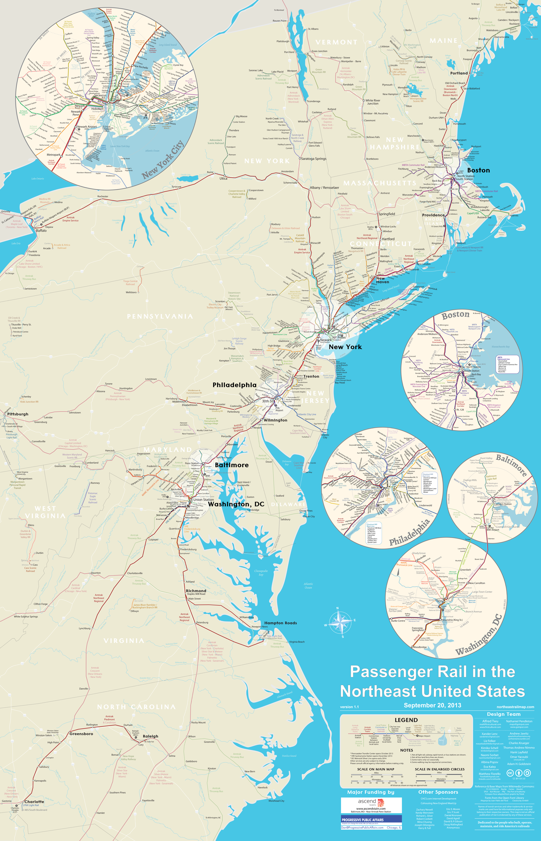
Image from NortheastRailMap.com.
Update: The map’s author has requested that you “like” their page on Facebook. Please help them out and do that!
 Cross-posted at Greater Greater Washington.
November 5th, 2013 | Permalink
Tags: commuterrail, intercity, lightrail, maps, metrorail, streetcar, transportation


