Features
Transit-related:
Transit Vision: BeyondDC's plan for regional transit expansion
Streetcars vs Buses: Why streetcars are better
Renamed Metro Stations: No bloody slashes, dashes or unnecessary acronyms

General:
Skyscrapers: Directory of tall buildings
Urban Profiles: Info pages for inner city neighborhoods and important suburbs
Scaled Cities: Comparisons of city geography to scale
Neighborhood Map: Aerial photo of DC with neighborhood labels
Houses of God: The great religious buildings of Washington
Framing The Mall: BeyondDC's comments on the NCPC plan for the areas around the National Mall


Site
About BeyondDC
Archive 2003-06
Links
Link to Us
Photo Usage
Contact Us

Subscribe:
BeyondDC blog
Flickr photostream
Twitter feed
Twitter via RSS

Search:

GoogleBeyondDC
Category Tags:


Blogs about urban issues in and around Washington, DC

Urbanist blogs nation-wide

PLANetizen Top 50 Website 2003

TBD Community Network Member - All Over Washington

Blog
Google Bikes

Commuter Connections launched an online Google Maps-based bike route finder. It works just like the well-known “driving directions” feature, but instead of selecting the fasted driving route, selects the best route for cycling.

The route finder is still in beta (and is pretty slow), but is publicly available to anyone who wants to give it a try.
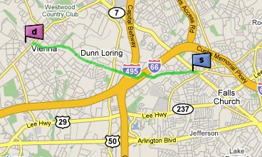
click for the route-finder
Falls Church to Vienna - the route finder knows to send you on the W&OD trail rather than streets.

April 22nd, 2009 | Permalink | |
Tags: transportation


Twitter


    Go to BeyondDC @ Twitter

    Photo Galleries


    Transit Library


    Around The DC Region


    Other Cities


    Aerials


    DC Region (pre-2004)


    Annual Highlights


    Go to BeyondDC @ Flickr


    BeyondDC v. 2009 | All rights reserved | 2003-2006 archive | Contact |