


BeyondDC is a map geek. I decorate my walls with maps, I love the Strange Maps Blog, and I absolutely cannot live without a decent GIS.
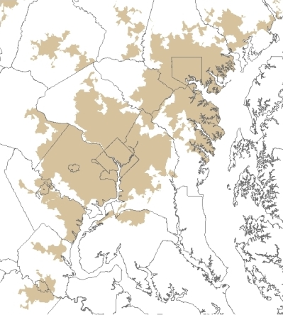
Below is a map showing the census-designated Urbanized Areas in the Washington region. Essentially, tan means the population density at the time of the 2000 census was at least 1, 000 people per square mile, and that the continuous area of that minimum density forms a city or town of certain minimum size. Small, isolated towns (like Lexington Park) are left off.
Looking at the map, I’m struck by the resiliency of the diamond shape. For no reason other than natural growth rate, most of the DC suburbs fit into a diamond very much like the original boundary of DC/Arlington, only bigger. Like so:
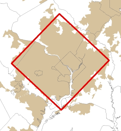
Oh sure, there’s the arc down in Prince William and the tentacles leading to Leesburg, Frederick and Waldorf, but most of the region fits almost perfectly into a diamond.
There’s no point to all this; I just found it mildly interesting. Any readers not bored silly by this post officially qualify as map geeks too.


