


Back in 1926, a robust network of steamship routes ferried passengers up and down the Chesapeake Bay and Potomac River. This map shows how part of that network functioned.
The map only shows lines that served Baltimore, so it’s probably a safe bet that DC had more than just the one.
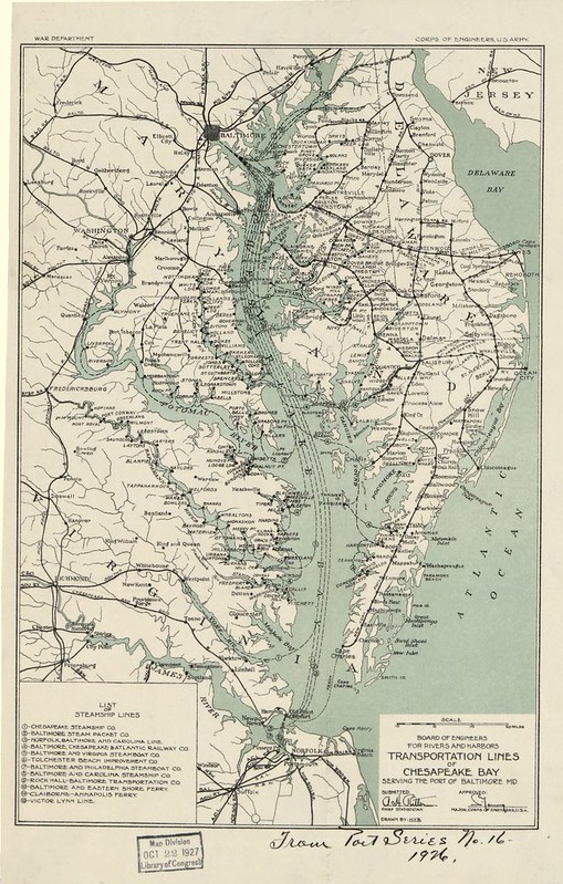
Public domain image from the US Library of Congress.
Originally produced by US Army.
Average Rating: 4.9 out of 5 based on 192 user reviews.
July 10th, 2013 | Permalink
Tags: history, transportation


