


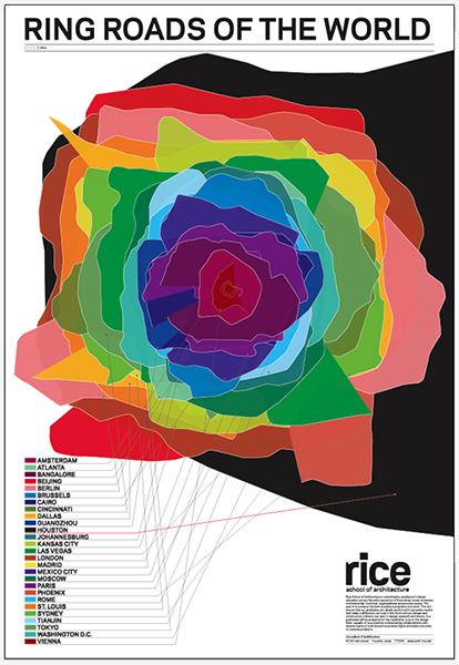
 Ever wondered how the circumference of the Beltway stacks up to other ring roads in cities around the world? A team from Rice University collected ring roads from 27 international cities and layered them all at the same scale in the image at right (click to enlarge). Of the cities they layered, Houston’s beltway is the largest; Washington’s is smack in the middle.
Image from Thumb Projects, first dispersed on the blogosphere by Swamplot (where in Texan fashion, they’ve mistaken “big” for “win”).
Average Rating: 4.8 out of 5 based on 253 user reviews.
May 19th, 2009 | Permalink
Tags: fun, transportation


