


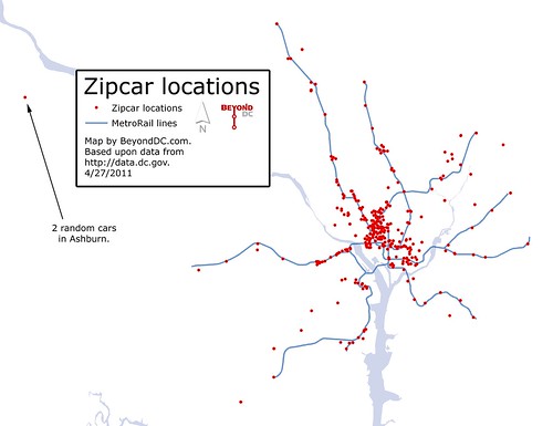
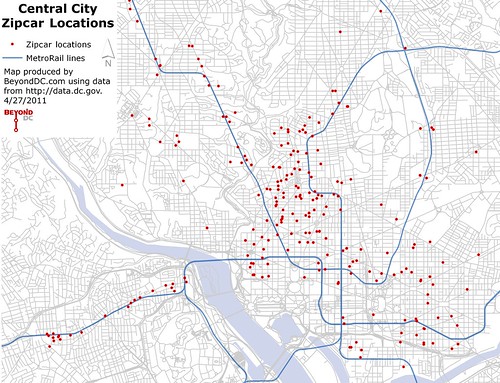
Another entry in this week’s series of maps from the District’s GIS data catalog: Zipcar locations. A regional map at left, with the urban core at right. Click either for larger versions.
Note that to keep these maps simple I’m not putting much on them in regards to geographic reference points. I’m assuming that most readers are familiar enough with regional geography to read the maps without street labels or other detailed reference material. That information could be added, but I’m interested in seeing these with as little visual clutter as possible, and I assume that at least some of you are interested as well.
Average Rating: 4.5 out of 5 based on 274 user reviews.
April 27th, 2011 | Permalink
Tags: galleries, roads/cars, transportation


