|
Special Features


Image Libraries


|
|
Blog
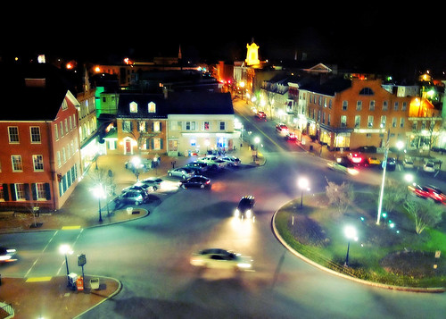
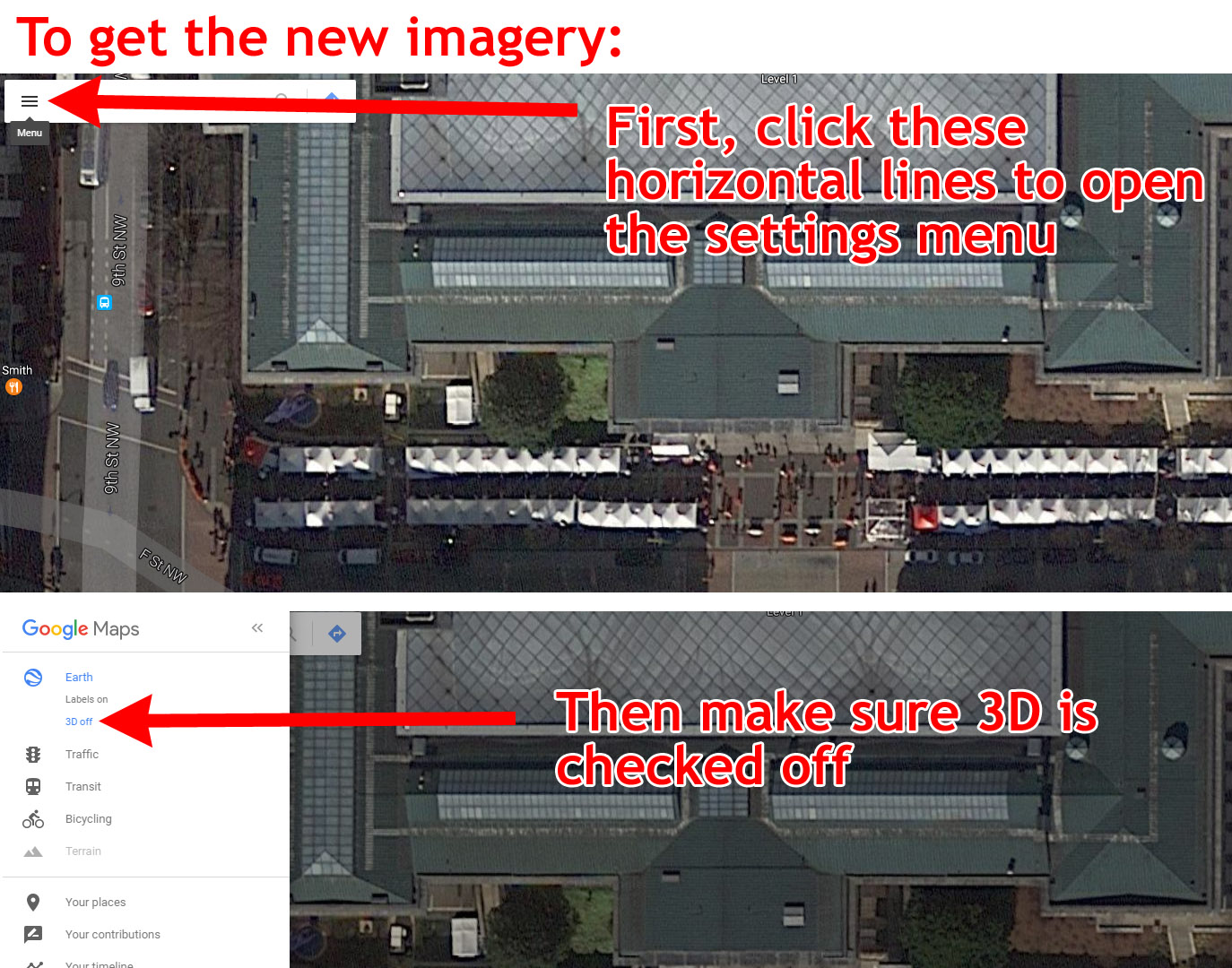
Google Maps now has brand new satellite images for the Washington region. The new photos, from December 19, 2016, show a cutting-edge view of our city.

New images from December 19 show the Downtown Holiday Market in full swing. Image by Google.
The new images only appear with certain settings. If you’re viewing in the default settings, you still get older photos. Here are instructions for how to change your browser settings to get the new imagery.
Also, the new pictures only cover part of the region; imagery for the Dulles Airport Metro station, for example, is from April.
Here are some highlights
The Georgia Avenue bus lanes, in all their red glory:

Image by Google.
The National Museum of African American History and Culture:

Image by Google.
Construction at Capitol Crossing, atop I-395:

Image by Google.
Preparations for inauguration on Pennsylvania Avenue. And are those moving trucks on the White House driveway?

Image by Google.
MGM casino at National Harbor:

Image by Google.
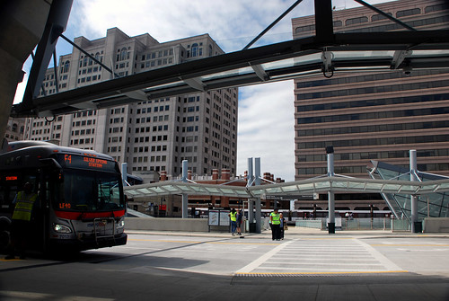
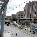
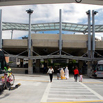
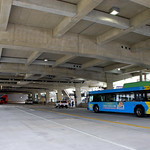
Takoma-Langley Crossroads transit center:

Image by Google.
The Wharf, at the Southwest Waterfront:

Image by Google.
And finally, the hole where the Washington Post used to be:

Image by Google.
What else can you find that's new?
 Comment on this at the version cross-posted to Greater Greater Washington. Comment on this at the version cross-posted to Greater Greater Washington.
Average Rating: 4.8 out of 5 based on 160 user reviews.
January 25th, 2017 | Permalink
Tags: galleries

DC Streetcar is open and carrying passengers, following a festive opening day on Saturday. Enjoy this photo tour reliving the fun.
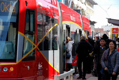
Continue reading at Greater Greater Washington
Average Rating: 4.4 out of 5 based on 166 user reviews.
February 29th, 2016 | Permalink
Tags: events, galleries, streetcar, transportation
Part of the appeal of the cultural juggernaut that is Star Wars has always been its fantastic settings, including its cities. As The Force Awakens arrives in theaters today, here are the five most fascinating cities from the six previous live-action Star Wars movies.
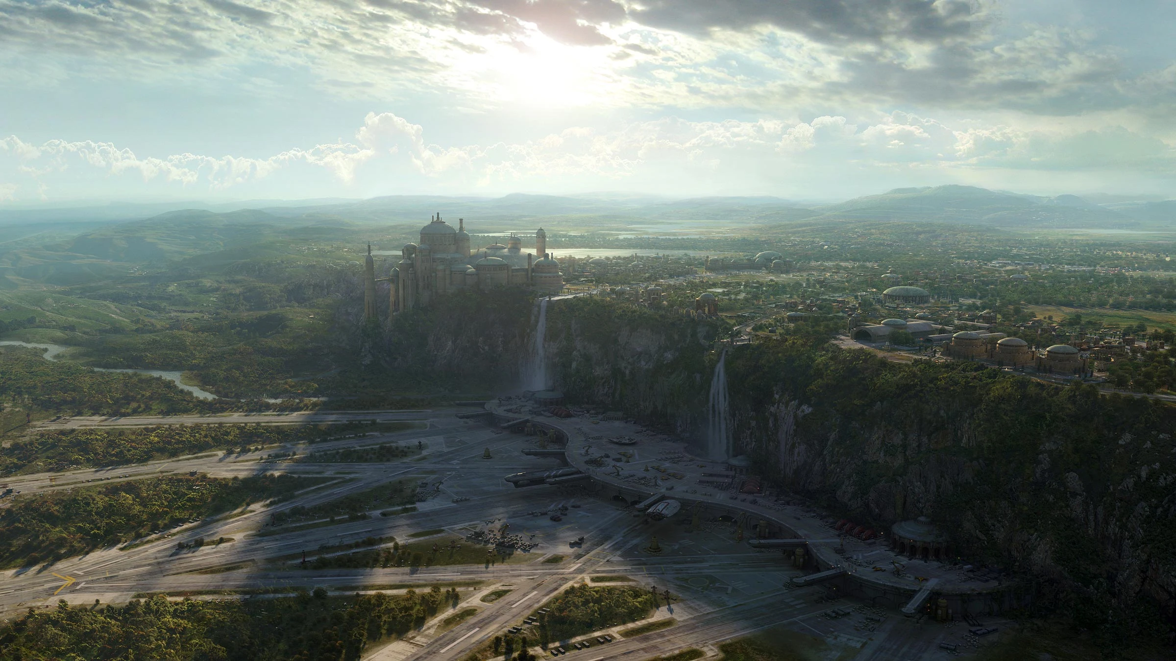
5. Theed

Theed. Image from Star Wars.
The Phantom Menace may have been a disaster of a movie, but its setting at the height of the galaxy’s pre-Empire luxury showed us a strong contender for the most beautiful city in the franchise. Theed is Queen Amidala’s home, and capital of the planet Naboo.
Picturesque Naboo is the Neoclassical Europe of the Star Wars universe. Its ornate buildings and grand, monument-strewn avenues are an idealized version of the Baroque Mediterranean. There’s no visible traffic or industry, besides one spaceport at the bottom of a waterfall. Theed’s citizens appear to do nothing but shop and picnic.
It’s the Garden of Eden of the Star Wars universe. Perfect and naive, and out of place once the galaxy descends into evil and civil war.
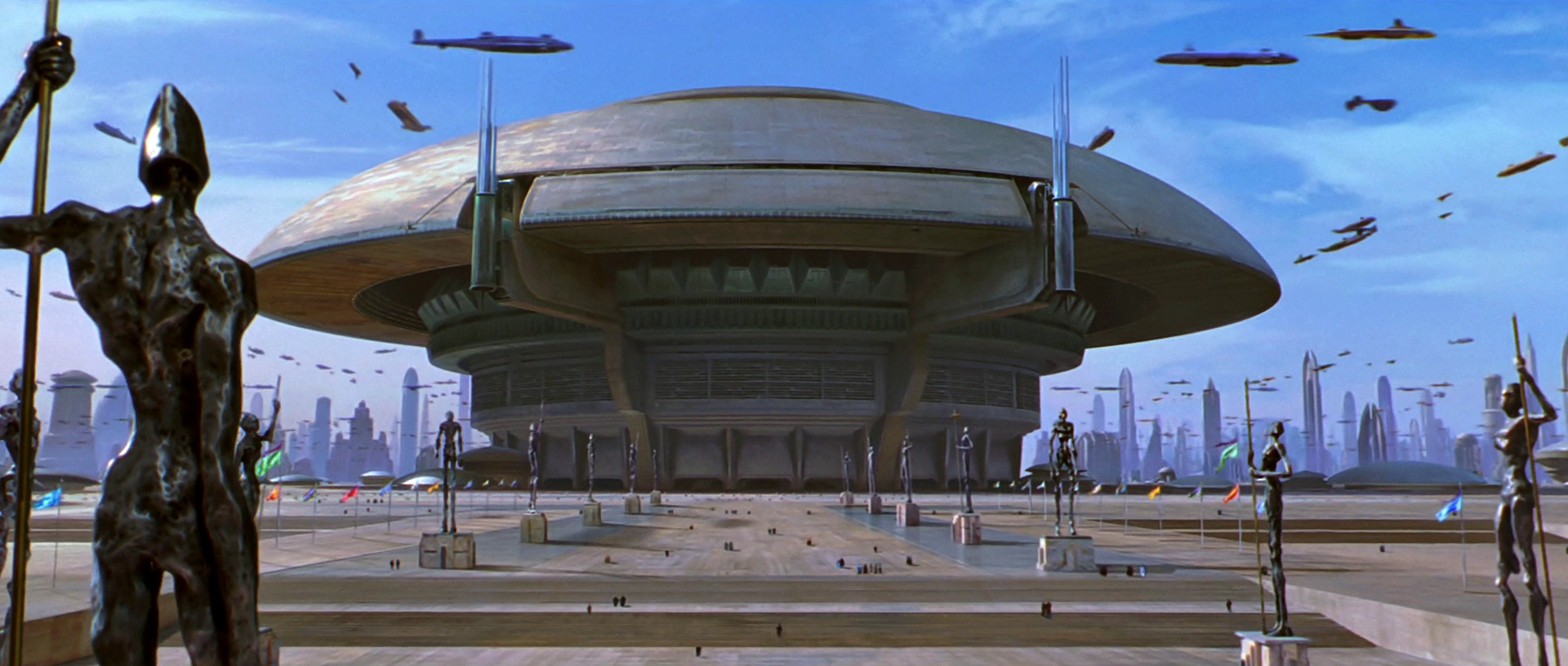
4. Mos Eisely

Mos Eisely. Image from Star Wars.
The complete opposite of Theed, Mos Eisely is a frontier settlement on a poor and dirty planet, a wretched hive of scum and villainy. If Theed is Habsburg Vienna, Mos Eisley is Dodge City. Its famous cantina nothing so much as a wild west saloon.
There’s precious little art of culture in Mos Eisley. Its hardscrabble populous struggles to survive, and its streets are full of pack animals, cargo crates, and industrial equipment.
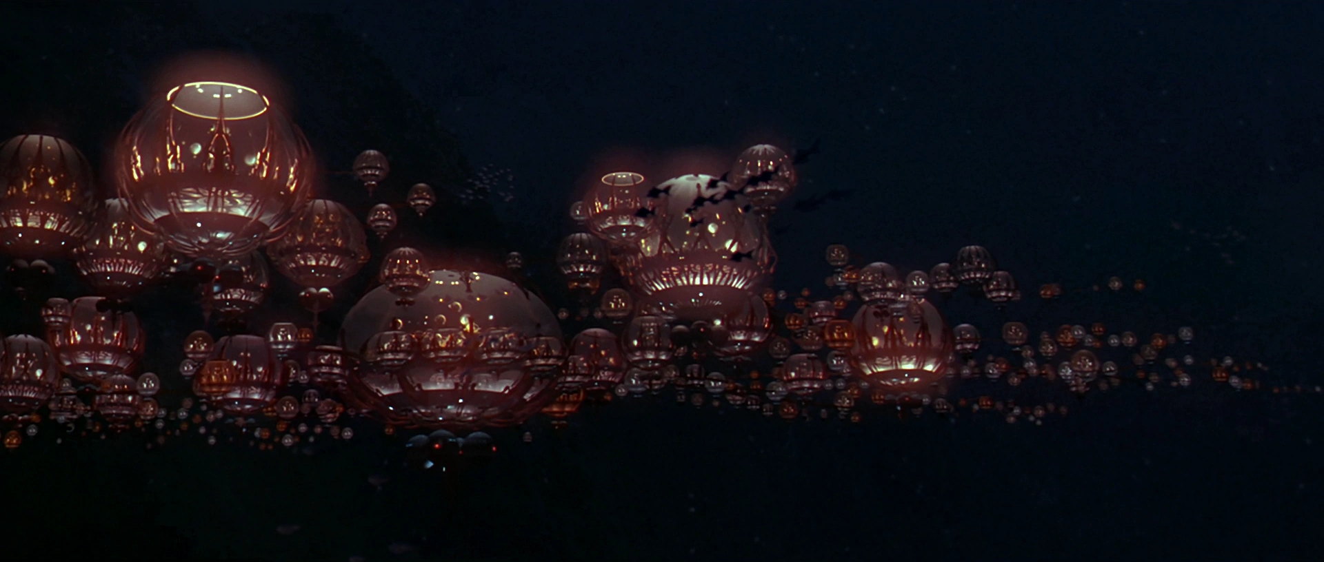
3. Gungan City

Gungan City. Image from Star Wars.
Return to Naboo for the secret underwater Gungan City. It’s beautiful, but like all things Gungan, it makes little sense.
With a fairly small number of orbs that appear to be mostly empty air, Gungan City is clearly more of a village than a metropolis. Maybe the Gungans prefer isolation, or maybe they’re too clumsy to live many side-by-side. Hopefully we’re never forced to sit through more Gungan scenes, and therefore never find out.
One would think that if Gungans are such great swimmers that they’re happy to build underwater cities, they’d spread their city vertically as much as sideways. Guess not.
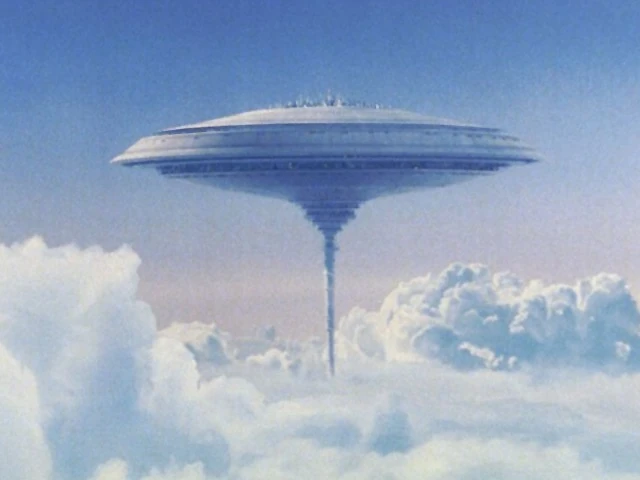
2. Cloud City

Cloud City. Image from Star Wars.
High-concept sci-fi at its best, Cloud City is an atmosphere-mining colony on a gas giant planet with no solid surface.
Its workers harvest gases for use in Star Wars’ futuristic technologies, and its government is more corporate CEO than democratic president.
Being an expensive floating factory, Cloud City’s layout and infrastructure are necessarily vastly different from a cobbled-together frontier town like Mos Eisley. As a single, purpose-designed mega-structure, Cloud City needs nothing so messy as parking lots, and piecemeal expansions are strictly not happening.
And if you approach it without an invitation, cloud cars shoot at you. It’s the ultimate gated community.
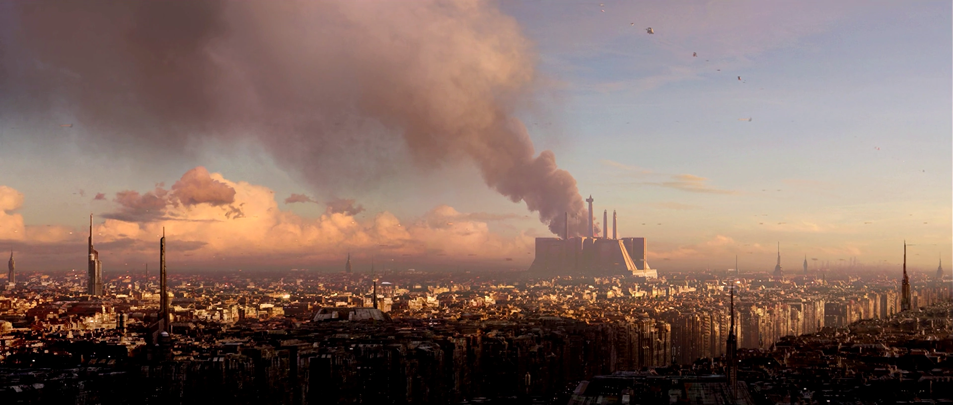
1. Coruscant

Coruscant. Image from Star Wars.
One city that covers a whole planet. Coruscant is either the ultimate in sprawl, or the ultimate in extreme urbanization. Given what we’ve seen on-screen, it seems to be the latter.
Like Washington, the capital of the Star Wars galaxy clearly has a height limit, with a canopy of blocky same-height buildings rolling over the landscape, and monuments like the Jedi Temple (above) dominating the skyline. But unlike DC, Coruscant’s city planners allow frequent skyscrapers to pierce the blocky canopy.
Unlike other Star Wars cities, Coruscant features busy air-highways, crowded with flying transports. But there don’t seem to be enough vehicles to move around a population as dense as Coruscant’s must be. Surely the planet is a public transit paradise.

Coruscant’s galactic capitol building, with air-highways. Image from Star Wars.
What will we see next?
If the past is any guide, The Force Awakens promises even more aliens and sci-fi landscapes. When I see it, I’ll be hoping to see some fun cityscapes too. And, I admit, a few light-saber duels.
Comment on this at the version cross-posted to Greater Greater Washington.
Aimee Custis contributed to this post.
Average Rating: 4.9 out of 5 based on 297 user reviews.
December 18th, 2015 | Permalink
Tags: fun, galleries, urbandesign
In the mid 1970s, Metro’s first stations were under construction and on track for their 1976 opening day. This historic photo shows Metro Center station while it was under construction, circa 1975.

Metro Center circa 1975. Photo source unknown.
In the photo, the basic form of the station is in place. The vault is done, the track bed looks good, and the station’s lights are on. But there’s clearly a lot of work left to do, including most of the finishing touches.
It’s an interesting 40-year-old look at one of our region’s most important transit hubs.
Comment on this at the version cross-posted to Greater Greater Washington.
Average Rating: 4.6 out of 5 based on 152 user reviews.
December 17th, 2015 | Permalink
Tags: galleries, history, metrorail, transportation
This is Main Street on Mackinac Island, in Lake Huron, Michigan. It’s a Michigan state highway, M-185, and it’s car-free year round.

Photo from Google.
M-185 encircles Mackinac Island, and forms the main street of the island’s town.
There’s no bridge to Mackinac Island. Visitors access it via airplane or ferry. With a lot of tourists but not many cars, M-185 has been car free since 1898.
I’ve never been there, but it looks pretty impressive in photos.
Have you been to Mackinac? Tell me what you think in comments at GGW.

The density of parked bikes looks like the Netherlands. Photo by Jasperdo on Flickr.

Photo by Jasperdo on Flickr.

Photo by Jasperdo on Flickr.

Bike for rent. Photo by ellenm1 on Flickr.
Comment on this at the version cross-posted to Greater Greater Washington.
Average Rating: 4.6 out of 5 based on 168 user reviews.
October 19th, 2015 | Permalink
Tags: bike, galleries, transportation
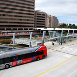
More photos at GGW and via Flickr/BeyondDC and Flickr/TheCourtyard.
Average Rating: 5 out of 5 based on 247 user reviews.
September 21st, 2015 | Permalink
Tags: bus, galleries, transportation
Last night’s heavy storm produced a truly breathtaking evening sky. Here are seven spectacular photos from around the region.
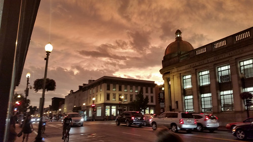
M street, Georgetown.
According to Capital Weather Gang, the storm washed pollutants from the air at exactly the right moment. The clear air combined with dramatic clouds and red light from the sunset to produce the memorable view.
> Read more
The rest of this post uses photos from the GGW Flickr pool. Therefore the full post only appears on Greater Greater Washington.
Average Rating: 4.6 out of 5 based on 233 user reviews.
June 24th, 2015 | Permalink
Tags: environment, fun, galleries
The northern lights, aurora borealis, are usually only visible near the Arctic Circle. But every once in a while, when conditions are perfect, they make an appearance as far south as DC. I caught a glimpse early Wednesday morning.
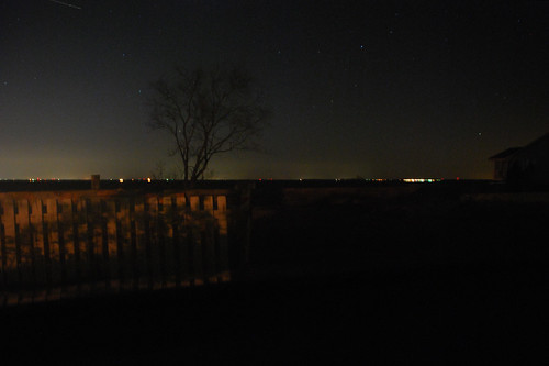
Aurora over Chesapeake Bay on Wednesday morning.
On Tuesday news spread that a heavy solar storm was hitting Earth, and producing some of the strongest aurora in years. Maybe strong enough to see from DC.
Since the sky was clear, the moon below the horizon, and conditions perfect, my wife and I booked a Zipcar to the clearest northerly view I could think of: The northern tip of Kent Island, across the Bay Bridge, in the middle of the Chesapeake.
And there was the aurora. Barely visible, but there. Dim green flashes floated low against the horizon, flowing in great fast waves from east to west. It was nothing like the huge curtains of light you see in the famous pictures (we’re too far south for that), but it was unmistakable nonetheless.
How you can see them next time
Aurora are sometimes visible from DC’s latitude. But they may never be visible from inside the District of Columbia, because this far south they appear very dim, and only close to the northern horizon. To see them, find an extremely dark north-facing vantage point, with a clear sight of the horizon.
If there are street lights turned on or trees blocking the horizon, you probably won’t see them even if conditions are otherwise right.
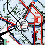
Since we live in Northeast, we decided Kent Island would be ideal. It’s about an hour drive east of DC, assuming no traffic—usually a safe assumption after midnight.
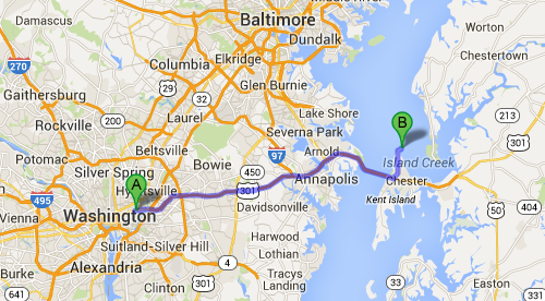
Route to Kent Island. Map from Google.
You will need a car to get there. And since news of likely aurora this far south typically only comes the day of the event, you won’t have much time to plan ahead. But in the age of car-sharing, even a car-free urbanite can get it done.
Cross-posted at Greater Greater Washington.
Average Rating: 4.8 out of 5 based on 201 user reviews.
March 19th, 2015 | Permalink
Tags: fun, galleries, in general
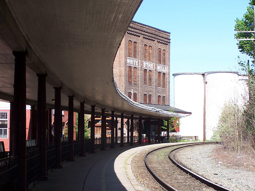
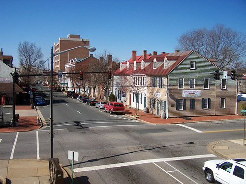
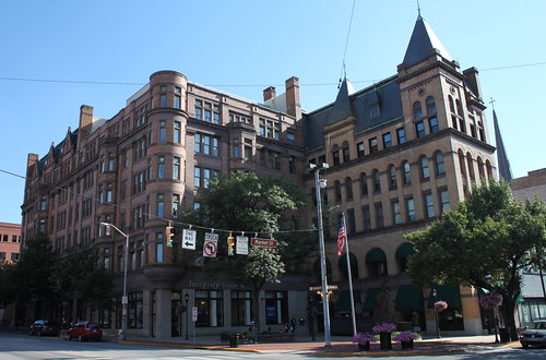
Central cities are booming all over the US, as Americans rediscover the benefits of walkable urbanism. But the boom isn’t confined to only big cities. Smaller cities are also enjoying a renaissance of their own.
Here are ten little cities near DC with genuinely great urbanism.
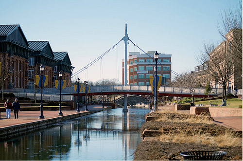 Frederick, MD: With stately historic buildings, fancy restaurants, rowhouse neighborhoods, and the best riverwalk in the region, Frederick is a bona fide quality city. Photo by Gray Lensman QX! on Flickr. Frederick, MD: With stately historic buildings, fancy restaurants, rowhouse neighborhoods, and the best riverwalk in the region, Frederick is a bona fide quality city. Photo by Gray Lensman QX! on Flickr.
 Hagerstown, MD: Less fancy and more blue-collar compared to Frederick, Hagerstown’s solid core of 19th Century streets is more like Baltimore than DC. Photo by J Brew on Flickr. Hagerstown, MD: Less fancy and more blue-collar compared to Frederick, Hagerstown’s solid core of 19th Century streets is more like Baltimore than DC. Photo by J Brew on Flickr.
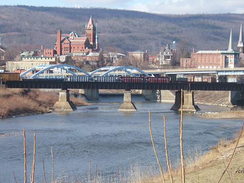 Cumberland, MD: If Frederick is a mini DC and Hagerstown a mini Baltimore, Cumberland with its sharply rising hills and narrow valleys is a mini Pittsburgh. Photo by Dave Olsen on Flickr. Cumberland, MD: If Frederick is a mini DC and Hagerstown a mini Baltimore, Cumberland with its sharply rising hills and narrow valleys is a mini Pittsburgh. Photo by Dave Olsen on Flickr.
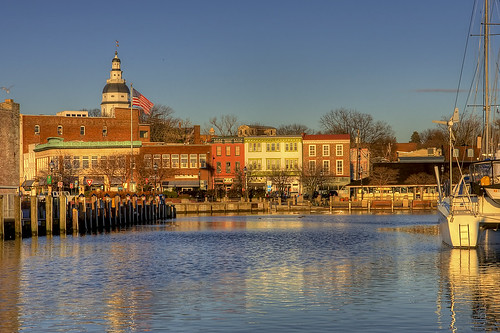 Annapolis, MD: With its baroque street grid, 18th Century state house, and as the home of the Naval Academy, Annapolis was an impressive town years before DC existed. Annapolis, MD: With its baroque street grid, 18th Century state house, and as the home of the Naval Academy, Annapolis was an impressive town years before DC existed.
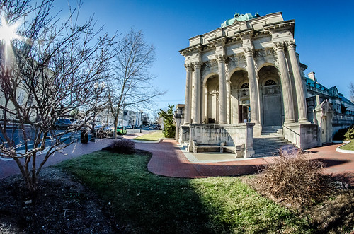 Winchester, VA: Winchester has a successful pedestrian mall, and the most gorgeous library in Virginia. Handley Library photo by m01229 on Flickr. Winchester, VA: Winchester has a successful pedestrian mall, and the most gorgeous library in Virginia. Handley Library photo by m01229 on Flickr.
 Charlottesville, VA: Charlottesville’s pedestrian mall is even more successful than Winchester’s, while the University of Virginia contributes The Corner, an interesting student ghetto neighborhood, and Thomas Jefferson’s famous Lawn. Photo by Ben G on Flickr. Charlottesville, VA: Charlottesville’s pedestrian mall is even more successful than Winchester’s, while the University of Virginia contributes The Corner, an interesting student ghetto neighborhood, and Thomas Jefferson’s famous Lawn. Photo by Ben G on Flickr.
 Staunton, VA: 19th Century warehouse town sister to nearby Charlottesville’s academic village. Photo by BeyondDC on Flickr. Staunton, VA: 19th Century warehouse town sister to nearby Charlottesville’s academic village. Photo by BeyondDC on Flickr.
 Fredericksburg, VA: Similar in size and scale to Old Town Alexandria, if it were 50 miles from DC instead of right across the river. Photo by BeyondDC on Flickr. Fredericksburg, VA: Similar in size and scale to Old Town Alexandria, if it were 50 miles from DC instead of right across the river. Photo by BeyondDC on Flickr.
 York, PA: Probably the most substantial city on this list, York is a veritable museum of 18th, 19th, and early 20th Century buildings. And its surrounding Amish countryside offers an object lesson in sharing the road. Photo by Joseph on Flickr. York, PA: Probably the most substantial city on this list, York is a veritable museum of 18th, 19th, and early 20th Century buildings. And its surrounding Amish countryside offers an object lesson in sharing the road. Photo by Joseph on Flickr.
 Gettysburg, PA: The battlefield is justifiably more famous, but downtown Gettysburg is a charming little place, often overlooked. Photo by Tom Hart on Flickr. Gettysburg, PA: The battlefield is justifiably more famous, but downtown Gettysburg is a charming little place, often overlooked. Photo by Tom Hart on Flickr.
Not enough? Don’t miss Ellicott City, Manassas, Leesburg, Martinsburg, Warrenton, Front Royal, Culpeper, Harrisonburg, Brunswick, Harper’s Ferry, and many more.
To qualify for this list, I excluded cities large enough to have tall buildings downtown (sorry Baltimore, Richmond, Harrisburg, and Wilmington), and any city close enough to DC be accessible via WMATA (Alexandria, Silver Spring, Kensington, etc). Otherwise the list is essentially subjective.
Cross-posted at Greater Greater Washington.
Average Rating: 4.4 out of 5 based on 230 user reviews.
November 4th, 2014 | Permalink
Tags: galleries, top10
Metro’s new Silver Line is officially open and carrying passengers. Enjoy this photo tour of the new line and opening day festivities.
> Continue reading at Greater Greater Washington
Average Rating: 4.9 out of 5 based on 167 user reviews.
July 28th, 2014 | Permalink
Tags: architecture, development, events, galleries, metrorail, transportation
|
Media


Site
About BeyondDC
Archive 2003-06
Contact
Category Tags:
Partners
|


