


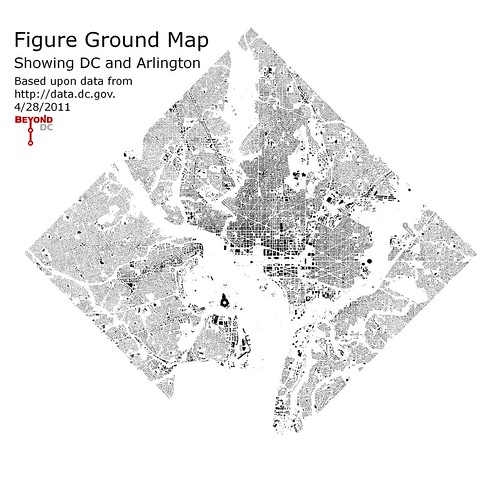
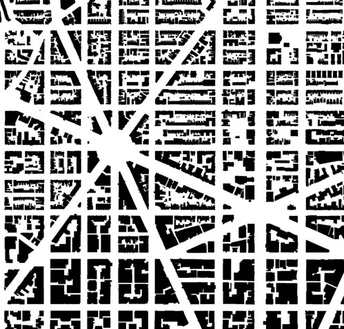
Continuing this week’s series of simple DC maps, today BeyondDC presents the figure ground map – a silhouette of building footprints.
The whole of DC and Arlington on the left, with a detail of Dupont Circle at right. Click either image for a larger version.
Average Rating: 4.8 out of 5 based on 182 user reviews.
April 28th, 2011 | Permalink
Tags: galleries, urbandesign


