|

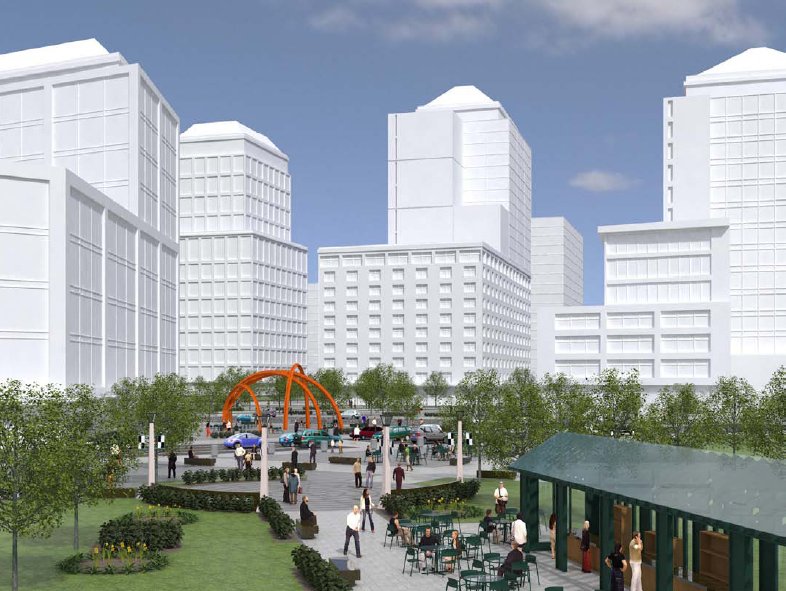
Bryant Park, or Tysons Corner?

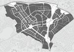
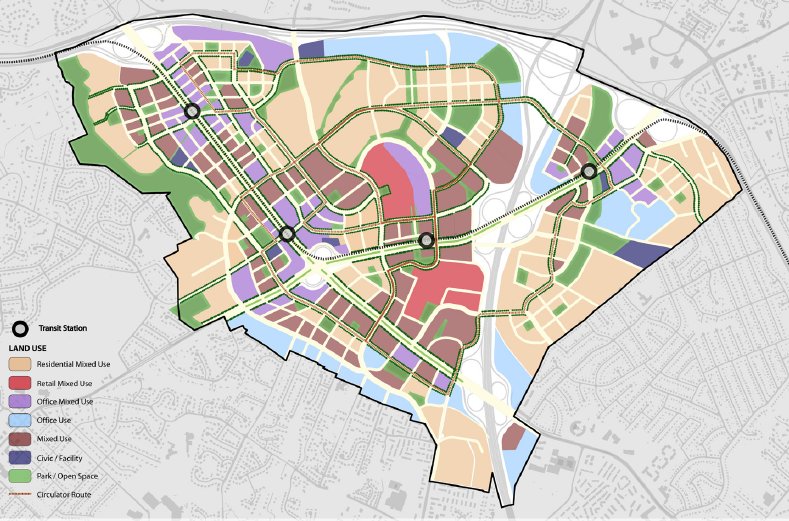
Proposed Tysons land use.
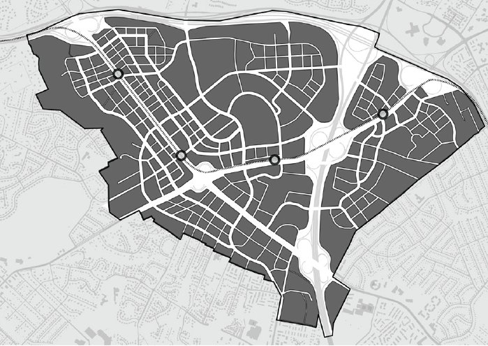
Proposed new street grid. |
Tysons Corner is the most important activity center in the Washington region after downtown DC itself. Tysons has more office space than all but about a dozen of the country’s largest downtowns, and is one of the nation’s biggest retail meccas. It is the thousand-pound gorilla in our midst, and cannot be ignored just because it’s in Fairfax County.
Because Tysons in such a behemoth, transforming it from a wasteland of parking lots into legitimate urbanism (that can accommodate more density and therefore reduce sprawl) is one the highest Smart Growth priorities in the region. It’s why providing top-quality transit access via the Silver Line is the essential next-step of Metro’s expansion, and why Fairfax County is committed to the Tysons Land Use Task Force’s Transforming Tysons Vision, which at its most basic level calls for a more pedestrian-friendly, mixed-use Tysons Corner reminiscent of a bona fide downtown.
Greater Greater Washington opined about the plan last week, now it’s BeyondDC’s turn. We’re not going to bother explaining the plan (y’all can read it on your own), but will just jump right in with our comments:
- Tysons is so geographically huge that the entire area is unlikely to transform, so the Vision correctly identifies intensity nodes around each proposed Metro station. It strikes BeyondDC that as this plan becomes reality, we may need to begin thinking of Tysons as a string of neighborhoods in the ilk of Rosslyn-Ballston rather than as a single place.
- Even if the main part of Tysons along Route 7 and near the two malls manages to coalesce into a something that feels like a single place, the portion east of the Beltway will always be separate; very few will ever walk from East Tysons to Tysons Galleria.
- Sooner or later we’re going to need names for these nodes that people can use. Tysons East, Tysons Central 123, Tysons Central 7 and Tysons West are too cold. Who wants to be from a neighborhood named after a highway number, adjacent to another neighborhood named after a highway number? As suggestions, we’ll toss out (from east to west) Scott Run, Galleria Center, Westpark and Spring Hill.
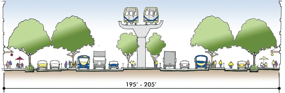
- Quality urbanism cannot be had with super-sized blocks, so the new street grid is absolutely essential, and welcome to see. For the most part the proposed streets are pretty well placed, though more connections to adjacent neighborhoods would help Tysons not to seem so insolated.
- If Tysons is to truly become Downtown Virginia, it will need more than just office towers, condos and department stores. The plan correctly identifies that one of the things currently lacking in Tysons is anything related to civic life. That includes parks and squares of course, but also libraries, post offices, etceteras. Fairfax County should commit to a government presence in Tysons. The next time a new courthouse or supervisor’s chambers are necessary, put them Downtown.
- Though the Vision illustrates mitigations to Routes 7 and 123 that will help those streets be more like Champs-Élysées than I-66, the interchange at Routes 7 and 123 remains a problem. It is a giant barrier, cutting off northwest Tysons from the south and east. Sooner or later the interchange will have to be removed.

Possible cross section of Route 7 or 123.
The “Old Courthouse South” subarea – the part of the Route 7 corridor southeast of the 123 interchange – is a big problem because currently it’s part of the very heart of Tysons, but is too distant from a Metro station to be considered a redevelopment priority. Though it will be a project for the next generation, eventually a light rail line on Route 7 between Tysons and Columbia Pike will likely be necessary.
To extend the reach of transit beyond the Metro station areas, the plan proposes a series of circulator bus routes. A necessary step, definitely, and it’s encouraging that the Vision proposes circulators operate in dedicated lanes (streets in Tysons are certainly wide enough). Looking at the proposed circulator route map, though, we’re a little worried it’s too complex. Several circulator routes may be necessary, but if so the DOT folks will need a Metrorail-like circulator system map to visually clarify the clutter of routes.
The open space plan is encouraging because it focuses primarily on providing a large number of small squares / pocket parks, rather than just one or two big tree-saves.
The vision includes a height limit chart, with taller buildings allowed close to Metro stations (as it should be). But even on top of stations, buildings are limited to 400 feet in height. That’s OK as long as our goal is to fill out the parking lots and wasted space of Tysons by building lots of individual buildings rather than 1 or 2 super skyscrapers, but it won’t take too many decades before all the good Metro-adjacent locations are built-out. When that day comes it will be time to reevaluate the height limit. Why shouldn’t Tysons have skyscrapers, after all?
We could go on, but overall the Vision pretty much says the things it needs to say. If Fairfax County follows this plan, Tysons Corner will eventually be at least the equal of Rosslyn-Ballston, which would be a huge accomplishment. The tough part will be sticking to the plan.
Average Rating: 4.6 out of 5 based on 240 user reviews.
September 16th, 2008 | Permalink
Tags: government, transportation, urbandesign


