


This map, produced by the Transportation Planning Board, shows “managed highway lanes” in the DC area. That’s planner jargon for HOV and tolls.
It’s only highways. It doesn’t show non-highway HOV, like along Route 1 in Alexandria. The map also appears to show I-495 incorrectly, since the Beltway HOT lanes are free for HOV-3.
But it’s still interesting to see which highways have special characteristics. One thing that pops out is how Virginia has a fairly comprehensive and interconnected network, while Maryland is more hit-or-miss.
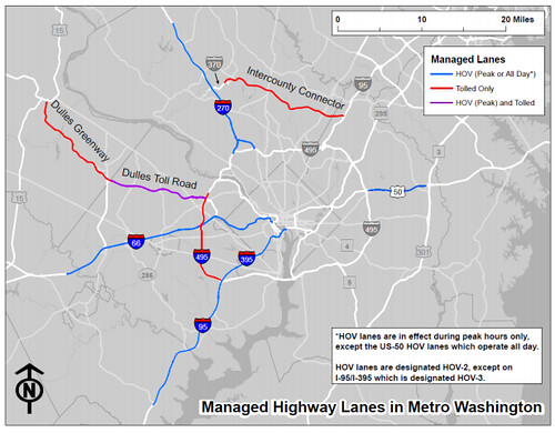
Managed lanes in the DC region, by TPB.
Average Rating: 4.7 out of 5 based on 243 user reviews.
May 2nd, 2013 | Permalink
Tags: maps, roads/cars, transportation


