


Frequent transit maps highlight bus and rail lines that come at least every 15 minutes. They’re great tools that help riders easily identify the most convenient routes.
Such maps exist for more than 20 cities around the US, including DC. Stuart Sirota of TND Planning Group made this one, for Baltimore.
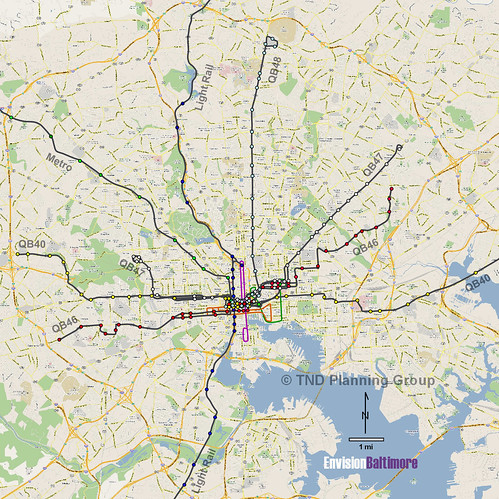
Baltimore frequent transit map, posted with permission from Stuart Sirota.
 Cross-posted at Greater Greater Washington.
Average Rating: 4.7 out of 5 based on 153 user reviews.
May 29th, 2013 | Permalink
Tags: bus, lightrail, maps, metrorail, transportation


