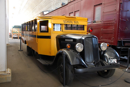
If you were an elementary school student the 1930s, this Dodge school bus might have been your ride. It carried students in Salem and Roanoke County, Virginia.
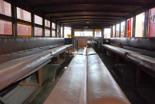
Check out the inside, with its child-sized benches and aisles. Who wouldn’t want to face the middle, or lean back against another kid?
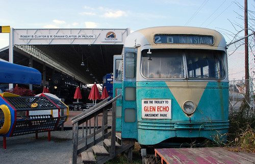
The bus is on display at the Virginia Museum of Transportation in Roanoke. The museum’s fascinating collection also includes this vintage 1945 streetcar from DC Transit. It ran on line 20, from Union Station to Glen Echo.
While planning for a 16th Street bus lane continues, DDOT has quietly made another important but nearly invisible improvement there: The traffic signals are now optimized for buses.
16th and U queue jump signal. Photo by the author.
33 traffic signals along 16th Street now have Transit Signal Priority, or TSP. TSP holds a green light a few seconds longer, or switches a red to green a few seconds sooner, if a bus is ready to pass through.
Stopping at fewer red lights speeds buses along a line. In particular, DC is using TSP on 16th Street to keep S9 buses on schedule. When one falls behind, the signal priority kicks in so that bus can catch up.
16th Street has so many buses that DDOT can’t give each one priority all the time, or it would gum up every perpendicular street along the line. But keeping buses on schedule is a nice improvement for riders.
16th & U queue jumper
In addition to TSP, at 16th and U there’s now a dedicated signal just for buses, called a queue jumper. It gives buses their own “go” signal a few seconds before cars get their green, allowing buses to jump ahead of a line of waiting cars. By the time cars get their green and start moving forward, the bus is in front of them rather than behind.
The bus signal looks different than a normal light, so car drivers don’t mistake it for one they’re supposed to follow. A horizontal bar means stop, and a vertical bar mean go. It’s the same as the dedicated streetcar signal at 3rd and H, and the same as bus signals along the Crystal City Potomac Yard transitway.
Traffic lights may not be as exciting as bus lanes, but these details matter. Thanks DDOT for making this progress.
Four years ago, Paris made headlines for its bus stop of the future, a bigger and better bus stop with amenities like bikesharing and a book-sharing library attached. Now College Park has a bus stop with some of the same amenities, but using inexpensive, off-the-shelf pieces.
College Park’s bus stop of the future.
Paris’ bus stop of the future
In 2012, Paris’s transit agency tried out a luxurious new bus stop design. In addition to the normal sign, bench, and shelter, the stop had electric bikes, bookshelves, wifi, and stylish architecture. It looked great and it made waiting for the bus more enjoyable, but it was expensive and took up a lot of space.
Paris’s concept was a neat idea, but wasn’t ultimately practical for mass production.
Paris’s bus stop of the future. Image from RATP.
But some of the ideas from Paris’s attempt make sense. Locating a bikeshare station next to a bus stop makes it convenient for more people to use both. And book-sharing can be a nice amenity, if it’s easy and inexpensive to manage.
College Park’s version
Enter College Park, where rather than design a custom building, the city simply added some of those components to an existing bus stop using their standard off-the-shelf pieces.
They started with a normal bus stop sign and shelter, then added a standard mBike bikeshare station. To help with maintenance, the city chained a bike tire pump to the station sign.
For the library, they staked to the ground a Little Free Library, a pre-fab wood box for people to take and give away free books. There’s no librarian and no library cards; it runs on the honor system, and relies on people donating as many books as they take.
A similar Little Free Library in California. Photo by Michael R Perry on Flickr.
The stop is at the corner of Rhode Island Avenue and Muskogee Street, in front of the Hollywood shopping center, just one block south of College Park’s first protected bikeway. The stop serves Metrobus lines 81 and 83, which are among the busier lines in Prince George’s County.
It’s no grand Parisian bus station, but that would be overkill. For a bus stop in a relatively low-density suburban area, it’s pretty darn nice.
DC’s first bright red bus lanes now adorn four blocks of Georgia Avenue, near Howard University. DDOT crews added the red surface earlier this month.
Georgia Avenue’s new red carpet for buses.
The bus lanes run along both curbs, from Florida Avenue north to Barry Place. They speed Metrobus’ busy 70-series line through what was the slowest section of Georgia Avenue north of downtown.
The bright red color is a strong visual clue to car drivers to stay out of the lane. It’s a stark contrast to the Gallery Place bus lane a dozen blocks south, which is so poorly marked that many car drivers legitimately don’t know it’s there. For these four blocks, drivers will have no excuse.
Anecdotally, the red surface seems to be working pretty well. Most car drivers seem to stay out. To find out for sure, DDOT is in the process of collecting actual data, comparing the car violation rate now to the rate from before the red surface was added.
Nitty gritty
Cyclists and taxicabs are allowed the use the lanes in addition to buses. Signs along the street spell out the exact rules.
Since the lanes are along the curb, cars can enter them to turn right. Dashed white lane markings show where cars can enter.
To avoid wear-and-tear and to make the bus lanes safer for cyclists, the “red paint” is actually a gritty surface coating. If you walk along Georgia Avenue now, you can still see some of the leftover grit along the curb.
❤ the transit red carpet
By adding these lanes and marking them clearly, DC is taking an real step towards prioritizing street space for transit. At only four blocks long they’re are a humble start, but a start nonetheless.
The “red carpet” is an increasingly common part of the street design toolbox in New York, Chicago, San Francisco, and Seattle. It’s great that DC is getting on board too.
With more transit lanes in the works for K Street, H Street, and 16th Street, this humble start will hopefully soon become a trend. A red surface would probably help them all.
April is going to be a huge month for bus lanes. On Monday, April 11, DC will open a four block stretch on Georgia Avenue. Then on Sunday, April 17, Arlington will open the Crystal City transitway.
Crystal City transitway station. Photo by Arlington.
Georgia Avenue
Georgia Avenue’s bus lanes will run just four blocks, from Florida Avenue to Barry Place. They’ll be curbside lanes, with normal bus stops on the sidewalk.
Location of Georgia Avenue bus lanes. Image from DC and Google.
Four blocks is short, but this location is specifically one of the slowest stretches WMATA’s busy 70-series bus line passes through. Bus lanes here will speed the entire line.
Just as importantly, this will be a test project for DDOT to study, and to learn about bus lane implementation. In May, crews will add red paint to the roadway to make the bus lanes more visually obvious. By adding the red surface later, DDOT will gather data on whether the red really does dissuade car drivers from using the lanes illegally.
Red-painted curbside bus lane in New York. Photo by NACTO.
If Georgia Avenue’s four block bus lanes prove successful, they could provide a model for the citywide transit lane network envisioned in moveDC. They could also one day form the backbone of a future Georgia Avenue streetcar.
They’re short, but they’re important.
Crystal City
Get ready for bona fide BRT.
On Sunday the 17th, Arlington will open the second half of the Crystal City Potomac Yard Transitway, better known as Metroway. The first half opened in 2014 in Alexandria, and was the Washington region’s first foray into BRT.
The new Crystal City transitway section will run from Crystal City Metro south to Alexandria, where it will join the existing busway. It’ll be a mix of curbside bus lanes and fully exclusive bi-directional busway.
Crystal City transitway. Image by Arlington.
The DC region once had 60 miles of bus-only lanes. With these projects finally happening, and others like 16th Street on the horizon, it’s exciting to see a reborn network begin to take shape.
There are more than 20 separate bus agencies in the Washington area. Why not run them all as part of WMATA? Some run outside WMATA’s geography, but the bigger reason is money: It costs less to run a local bus than a WMATA bus, translating to better service for less money on local lines.
Our region is a smorgasbord of overlaying transit networks, with little in common except, thankfully, the Smartrip card.
Why?
Three reasons, but mostly it’s all about money
Some of the non-WMATA bus systems can’t be part of Metro simply because buses go to places that aren’t part of the WMATA geography. Since Prince William County is outside WMATA’s service area, Prince William County needs its own system. Thus, OmniRide is born. Hypothetically WMATA could expand its boundaries, but at some point 20 or 40 or 60 miles out from DC, that stops making sense.
Another reason for the transit hodgepodge is control. Locals obviously have more direct control over local systems. That’s an incentive to manage buses close to home.
But the biggest reason is money. Specifically, operating costs.
To calculate how much it costs to operate a bus line, transit agencies use a formula called “cost per revenue hour.” That means, simply, how much it costs to keep a bus in service and carrying passengers for one hour. It includes the cost of the driver’s salary, fuel for the bus, and other back-end administrative costs.
Here are the costs per hour for some of the DC-region’s bus systems, according to VDOT:
WMATA Metrobus: $142/hour
Fairfax County Connector: $104/hour
OmniRide: $133/hour
Arlington County ART: $72/hour
Not only is WMATA the highest, it’s much higher than other local buses like Fairfax Connector and ART. OmniRide is nearly as high because long-distance commuter buses are generally more expensive to operate than local lines, but even it’s less than Metrobus.
This means the local systems can either run the same quality service as WMATA for less cost, or they can run more buses more often for the same cost.
At the extreme end of the scale, Arlington can run 2 ART buses for every 1 Metrobus, and spend the same amount of money.
In those terms, it’s no wonder counties are increasingly pumping more money into local buses. Where the difference is extreme, like in Arlington, officials are channeling the vast majority growth into local buses instead of WMATA ones, and even converting Metrobus lines to local lines.
Why is Metrobus so expensive to run?
Partly, Metrobus is expensive because longer bus lines are more expensive to run than shorter ones, so locals can siphon off the short intra-jurisdiction lines for themselves and leave the longer multi-jurisdiction ones to WMATA.
Another reason is labor. WMATA has a strong union, which drives up wages. The local systems have unions too, but they’re smaller and balkanized, and thus have less leverage.
Finally, a major part of the difference is simply accounting. WMATA’s operating figures include back-end administrative costs like the WMATA police force, plus capital costs like new Metro bus yards, whereas local services don’t count those costs as part of transit operating.
Montgomery County has a police department of course, and bus planners, and its own bus yards, but they’re funded separately and thus not included in Ride-On’s operating costs.
So part of the difference is real and part is imaginary. It doesn’t actually cost twice as much to run a Metrobus as an ART bus. But for local transit officials trying to put out the best service they can under constant budget constraints, all the differences matter.
It won’t appear immediately, but DC took a big step toward speeding up buses on 16th Street by recommending a rush-hour bus lane and a package of other ways to make bus service better.
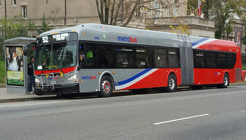
The 21 new articulated buses coming to 16th Street, 14th Street, and Georgia Avenue aren’t just prettier than the old buses. They’ll be a little faster, thanks to a more efficient interior layout.
One of the new buses. Photo from WMATA.
Not more buses, but better ones
These new accordion buses replace WMATA’s final remaining old-style articulated buses. When all 21 new ones are running, the last of the old buses with the boxy front will be retired.
Since the 21 new buses replace old ones that are also articulated, don’t expect to see more total articulated buses on 16th, 14th, or Georgia. There will simply be new buses instead of old ones.
But new buses have advantages: They break down less often, so the same number of buses are on the road more often. And their efficient low-floor design speeds up loading and unloading at stops.
Low-floor > high-floor
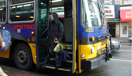
Riders boarding the old buses have to walk up steps, which creates a bottleneck and slows down service. It takes every able-bodied rider an extra half-second or so to climb bus steps, and less-able ones can take much longer. When a person in a wheelchair comes along, the delay can be significant.
A high-floor bus in Seattle. Photo by Oran Viriyincy.
On lines with very high ridership, all those seconds add up. Delays loading and unloading buses are one of the biggest sources of delay on 16th Street, and there’s no reason to think 14th or Georgia are any different.
Low-floor buses are more like trains—you step in, not up. One fluid and quick movement makes the whole process faster for everyone.
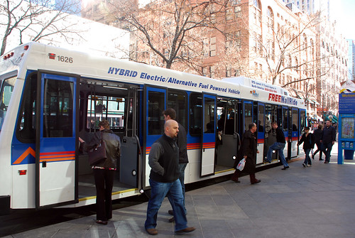
A low-floor bus in Denver. Photo by BeyondDC on Flickr.
With these new buses, WMATA’s articulated bus fleet will now be 100% low-floor. That’s legitimately good news.
A lot’s happening in DC’s busiest bus corridor
Every day there are over 75, 000 bus riders between downtown DC and Silver Spring. 50, 000 of them ride the Metrobus on 16th, 14th, and Georgia alone. Combined, they make up by far the busiest bus corridor in the Washington region.
Getting all those riders through town efficiently is a big task. Buses already come every few minutes on all three streets. In recent years WMATA has added express buses to 16th and Georgia, and DC added a Circulator line to 14th.
All those other things are important. Bus lanes are important. Nobody would suggest low-floor buses solve every problem. But they’re part of the solution, and it’s great to have them.


 Comment on this at the version cross-posted to Greater Greater Washington.