Special Features

Image Libraries

Blog


Photo by Wil C. Fry on Flickr.

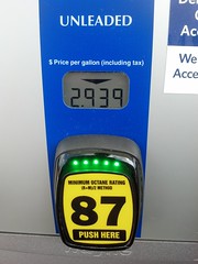
Gas prices have fallen below $3 per gallon in much of the US, and the explanation isn’t the simple seasonal differences that always make gas cheaper in autumn. The bigger reason: US oil shale deposits are turning the global oil market on its head.

How did cheap gas happen?

In the simplest terms, supply is up and demand is down.

Travel drops between the summer travel season and the holidays, and cooler fall temperatures actually make gas cheaper to produce. That’s why gas prices always fall in autumn.

But that’s not enough to explain this autumn’s decline, since gas hasn’t dropped this low in years. China is also using less gas than expected, but that’s also only part of the explanation.

The bigger explanation seems to be that supply is also up, in a huge way. North American oil shale is hitting the market like never before, and it’s totally unbalancing the global oil market. Oil shale has become so cheap, and North American shale producers are making such a dent in traditional crude, that some prognosticators are proclaiming that “OPEC is over.”

It’s that serious a shift in the market.

Will this last?

Yes and no.

The annual fall price drop will end by Thanksgiving, just like it always does. Next summer, prices will rise just like they always do. Those dynamics haven’t changed at all.

Likewise, gasoline demand in China and the rest of the developing world will certainly continue to grow. Whether it outpaces or under-performs predictions matters less in the long term than the fact that it will keep rising. That hasn’t changed either.

But the supply issue has definitely changed. Oil shale is here to stay, at least for a while. Oil shale production might keep rising or it might stabilize, but either way OPEC crude is no longer the only game in town.

Of course, oil shale herf=”http://www.businessweek.com/articles/2013-10-10/u-dot-s-dot-shale-oil-boom-may-not-last-as-fracking-wells-lack-staying-power”>isn’t limitless. Eventually shale will hit peak production just like crude did. When that happens it will inevitably become more expensive as we use up the easy to refine reserves and have to fall back on more expensive sources. That’s a mathematical certainty. But it’s not going to happen tomorrow. In the meantime, oil shale isn’t very scarce.

So the bottom line is that demand will go back up in a matter of weeks, and the supply will probably stabilize, but at higher levels than before.

What does this mean?

Here’s what it doesn’t mean: There’s never going to be another 1990s bonanza of $1/gallon fill-ups. Gas will be cheaper than it was in 2013, but the 20th Century gravy train of truly cheap oil is over.

Oil shale costs more to extract and refine than crude oil. Prices have to be high simply to make refining oil shale worth the cost, which is why we’ve only recently started refining it at large scales. Shale wouldn’t be profitable if prices dropped to 1990s levels. In that sense, oil shale is sort of like HOT lanes on a congested highway, which only provide benefits if the main road remains congested.

So shale can only take gas prices down to a little below current levels. And eventually increased demand will inevitably overwhelm the new supply. How long that will take is anybody’s guess.

In the ultimate long term, oil shale doesn’t change most of the big questions surrounding sustainable energy. Prices are still going to rise, except for occasional blips. We still need better sustainable alternatives. Fossil fuels are still wreaking environmental catastrophe, and the fracking process that’s necessary to produce oil shale is particularly bad. It would be foolish in the extreme for our civilization to abandon the progress we’ve made on those fronts, and go back to the SUV culture of the 20th Century.

There will probably be lasting effects on OPEC economies. The geopolitical situation could become more interesting.

In the meantime, enjoy the windfall.

 Cross-posted at Greater Greater Washington.


Average Rating: 4.4 out of 5 based on 284 user reviews.

October 28th, 2014 | Permalink
Tags: economy, energy, environment, roads/cars, transportation


Loudoun County is trying to come up with names for the two Metro stations west of Dulles that will open as part of the Silver Line Phase 2. Many of the options are terrible, but there’s an easy solution, and it looks like this:

The “Route 606″ station is inside the Sterling zip code. The “Route 772″ station is inside the Ashburn zip code. Done. No more thought needed. Those names are perfect.

Names like “Loudoun Dulles North” and “Loudoun Gateway West” are not descriptive and they won’t engender any sense of place. Metro station names need to be as short and obvious as possible. “Sterling” and “Ashburn” meet that test, while the other options don’t. The KISS principle absolutely applies.

The only real criticism of Sterling or Ashburn seems to be that the center of Sterling is a little further north than this station. So what? Reston Town Center is a little further north of what will become Reston Town Center station. Vienna station isn’t actually in the Town of Vienna. And Branch Avenue station is actually on Old Soper Road. It doesn’t matter because these names are supposed to be general. They’re supposed to roll off the tongue and be easy for riders to remember.

This doesn’t need to be so hard.

Average Rating: 4.9 out of 5 based on 253 user reviews.

October 23rd, 2014 | Permalink
Tags: metrorail, transportation


As Norfolk plans the next expansion of its burgeoning light rail system, a classic transit dilemma faces the community: Will the northern extension to Naval Station Norfolk run through rider-rich urban neighborhoods, or take the path of least resistance along wide suburban highways?


Potential light rail routes. Image from HRT.

Hampton Roads Transit is planning two light rail extensions. One, east to Virginia Beach, is relatively straightforward; it will follow an old rail right-of-way. The other, north to Naval Station Norfolk, is a challenge.

The northern extension will have to run on or adjacent to streets, and could follow any one of several alignments planners are currently considering.

If the light rail follows Granby Street, a tightly packed urban commercial street, or Hampton Boulevard, the main street through Old Dominion University, then it will probably capture a lot of local riders, since those are walkable transit-friendly destinations. On the other hand, adding transit lanes would be more disruptive for car drivers on narrow streets than on wider, more suburban highways, since there’s less space to go around.

Conversely, if the light rail follows the more easterly Military Highway, there will be plenty of space to accommodate trains without disrupting cars, and commuters to the navy base using park-and-rides near the end of the line will have a quick ride from their cars to the base.

But that alignment wouldn’t serve any strongly walkable neighborhoods; it would even miss downtown Norfolk. It would offer quick rides to one destination and easy construction, but the resulting line would be a glorified parking shuttle to the navy base, not the spine of a transit-oriented community.

Maybe after a few decades a Military Road alignment might induce enough transit oriented development that some of its stations could become walkable. Or maybe not. In the meantime, Norfolk’s genuinely urban neighborhoods will still need better transit.

Meanwhile, the Church Street alignment would split the difference by skirting the outer edge of downtown Norfolk, and the Chesapeake Boulevard alignment would snake along an indirect route that serves a few additional neighborhoods, but would be very slow from end to end. These options look like compromises unlikely to satisfy anybody.

Planners have already dropped the most urban alignment options, which would have gone through Norfolk’s dense Ghent neigborhood. Not only does that mean the most walkable part of Norfolk besides downtown will be without rail, but also that the western end of the existing light rail line will be a spur, forcing transfers.

Experience says pick the urban options

The fast and easy suburban options are tempting. Not only are they the path of least resistance, but computer models of traffic behavior probably predict that the more suburban routes capture the most navy base commuters.

But history shows light rail systems built like that don’t work very well. Computer models are good at predicting long distance car commutes, but bad at understanding travel in walkable areas. They naturally push planners towards park-and-ride oriented systems, when we know the most successful transit routes follow dense walkable corridors instead.

So Norfolk faces a choice: Embrace the city and build a transit line for the city, or follow a highway and build a park-and-ride shuttle.

 Cross-posted at Greater Greater Washington.


Average Rating: 4.6 out of 5 based on 180 user reviews.

October 21st, 2014 | Permalink
Tags: land use, lightrail, transportation


Look at this beautiful photo. Two cycletracks meet at a street corner, bike boxes and green paint flow in every direction, and a bikeshare station sits in the background. It’s almost Dutch. Almost.


15th and L, NW.

This is the corner of 15th and L Streets, downtown. It’s the only intersection in the DC region (so far) where protected bike lanes extend out in all four directions. It’s also home to the only two-stage bike box in the region. And as of Tuesday, it’s got a sparkling new bikeshare station.

Whether or not it’s really DC’s most bike-friendly corner is debatable. Certainly the heavy car traffic at 15th and L can make biking there uncomfortable, even with cycletracks. And while most bike movements through this intersection are easy, there’s still no good way to turn right off the L Street cycletrack onto southbound 15th Street.

But no other corner in the city packs so much bike infrastructure into one spot. According to that metric at least, this corner is tops.

And it’s right outside the Washington Post’s headquarters.

Cross-posted at Greater Greater Washington.


Average Rating: 4.5 out of 5 based on 156 user reviews.

October 9th, 2014 | Permalink
Tags: bike, transportation


Grosvenor Metro station. Photo by Isaac Wedin on Flickr.

Get ready for major construction along the Metrorail Red Line. Starting in the summer of 2016, WMATA will close portions of the Red Line between Friendship Heights and Grosvenor for 14 weekends, including one stretch of at least 7 consecutive weekends.

The good news is that in exchange for all those closures, Metro will complete a whole cadre of major rehabilitation projects up and down the line, and begin construction on the Purple Line. Instead of the piecemeal reconstruction that’s characterized Metro rebuilding elsewhere, this will be a comprehensive program that will solve several problems at once.

Metro will fix water leaks in the subway tunnel, repair the piers that hold up the elevated tracks near Grosvenor, rebuild the platform at Grosvenor, and begin construction on a new mezzanine at Bethesda station, for transfers to the Purple Line.

The most significant construction will happen just outside Medical Center station, where Metro workers will install a large arch between the tracks and ceiling, to help waterproof the tunnel.


Medical Center arch. Image from WMATA.

The work is necessary because water leaks in the subway tunnels have been causing electrical failures. In addition to waterproofing the area around Medical Center station, workers will power wash the tunnel, fix leaks in the tunnel, install better drain pipes, and replace tunnel lights and electrical cables.

Since the water leaks are an immediate problem that will take several weekends to fix, WMATA will take advantage of the station closures to do other work as well.

Workers will rehabilitate the elevated tracks near Grosvenor, where the metal bolts holding up the aerial structure have begun to degrade. Although the structure is not in any immediate danger of falling down, it could become a threat if Metro doesn’t fix the situation now.

At Grosvenor station itself, workers will replace the crumbling original platform tiles with the newer Takoma-style tiles the agency has been using in recent years.

Finally, Metro will begin construction on its portion of the Purple Line, at the Metro stations that will double as Purple Line transfer points. At Bethesda, workers will begin to install a second entrance and mezzanine. At Silver Spring, workers will begin to plan a similar connection, although construction won’t begin yet during this period.


Bethesda second mezzanine. Image from WMATA.

There’s no doubt all this construction will be painful for riders, but it’s better than the alternate. At one point, Metro management was considering completely closing this part of the Red Line 24×7 for at least five weeks. By closing only the weekends, at least the line will remain useful for commuters.

Correction: The initial version of this post implied that a new arch would go inside Medical Center station. It is actually in the tunnel just outside the station.

 Cross-posted at Greater Greater Washington.


Average Rating: 4.7 out of 5 based on 157 user reviews.

October 6th, 2014 | Permalink
Tags: events, metrorail, transportation


Media


Site
About BeyondDC
Archive 2003-06
Contact

Search:

GoogleBeyondDC
Category Tags:

Partners
 
  Greater Greater Washington
 
  Washington Post All Opinions Are Local Blog
 
  Denver Urbanism
 
  Streetsblog Network


BeyondDC v. 2013d | Email | Archive of posts from 2003-2006