Special Features

Image Libraries

Blog

Arlington’s Crystal City streetcar may have been canceled, but work is continuing on the dedicated transitway that would have carried it. Only buses will use this now, but the infrastructure is rising from the ground.

This is the Glebe Road station, in Potomac Yard.


Glebe Road station. Photo by Arlington.

When complete, it will look like this:


Station rendering. Image by Arlington.

 Cross-posted at Greater Greater Washington.


Average Rating: 4.4 out of 5 based on 215 user reviews.

November 28th, 2014 | Permalink
Tags: BRT, streetcar, transportation


After years of using exclusively smaller buses, Arlington Transit is now operating its first full-length 40-foot vehicles.


40-foot ART bus.

When Arlington launched its first ART bus routes in 1999, it used tiny jitneys that looked more like vans than real buses. Since then, as ART has gotten more and more popular, the agency has graduated to larger and larger vehicles.

In 2007, ART added its first “heavy duty” vehicles – buses that look like buses, not vans. Those were rare at first, but are now a common sight throughout Arlington.

These new 40-footers are the next natural step up.

Three of these big new buses now ply Route 41, and you may see them on other routes too.

 Cross-posted at Greater Greater Washington.


Average Rating: 4.5 out of 5 based on 221 user reviews.

November 25th, 2014 | Permalink
Tags: bus, transportation


In case anyone is wondering, as an Arlington employee it’s not prudent for me to blog about the Arlington County board’s decision to cancel the Columbia Pike and Crystal City streetcars.

Greater Greater Washington has excellent coverage of the issue, though.

Average Rating: 4.4 out of 5 based on 153 user reviews.

November 21st, 2014 | Permalink
Tags: events, government, streetcar, transportation


For Veteran’s Day festivities today, Metro is running an unusual service pattern, with no Blue Line. It’ll be rough for commuters, but neat for transit nerds. Why? Say hello to the Pink Line, for one day only.


“Special trains” between Arlington Cemetery and National Airport, illustrated with pink. Original image from WMATA.

Without regular Blue Line trains, Metro is running this special Pink Line to provide service to Arlington Cemetery, which otherwise wouldn’t have any trains.

The map doesn’t actually include the words “Pink Line” anywhere, and trains running this route will probably simply be labelled “Special, ” without any color.

But the map shows pink, so I think we can claim it.

 Cross-posted at Greater Greater Washington.


Average Rating: 4.5 out of 5 based on 206 user reviews.

November 11th, 2014 | Permalink
Tags: fun, metrorail, transportation


Maryland Governor’s Mansion. Image from the Boston Public Library on Flickr.

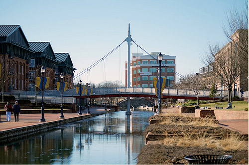
Despite years of work and broad community support to build the Purple Line, Maryland’s new Republican governor-elect may kill the project. Does Maryland’s heavily centralized state-level planning make it particularly susceptible to shifts like this one?

Most US states delegate transit planning to regional or municipal agencies, rather than doing it at the state level. Maryland is unusual. It’s geographically small and dominated by urban areas, and it has a history of governors interested in planning. So the state handles much more planning than usual, especially for transit.

That can be a mixed blessing.

When things go well, it means Maryland directs many more resources to transit than most other states. But it also means transit projects in Maryland are inherently more vulnerable to outside politics.

Maryland’s centralized system is designed under the assumption that Democrats will always control the state government, and therefore planning priorities won’t change very much from election to election. Were that actually the case, the system would work pretty well.

But recent history shows Maryland is not nearly so safe as Democrats might hope. With Larry Hogan’s election, two out of the last three Maryland governors have been Republicans. And they have different priorities.

Of course, it’s completely proper for political victors to have their own priorities. We live in a representative democracy, and we want it that way.

But shifting priorities are a big problem for any large infrastructure projects that take more than one governor’s time in office to complete.

It takes at least 10 years to plan and build something like a light rail line, or a new highway. If every new governor starts over, the project never gets done.

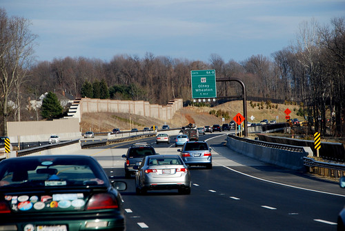
Thus, large infrastructure projects like the Purple Line, Baltimore’s light rail, and even highways like the ICC wallow in uncertainty for decades, shifting back and forth as one governor’s pet project and another governor’s whipping post.


Maryland’s spent literally half a century debating and re-debating whether or not to build the ICC highway.

While many states centralize their planning for highways, so much money automatically flows towards highway expansion that a lot of big road projects inevitably sail through without becoming political issues. Since transit rarely has dedicated funding for long term expansion, transit projects are more likely to become politicized.

And although this problem can happen anywhere, Maryland’s particular system centralizing transit planning under the governor’s office seems to make it par for the course.

When regional or local agencies control more of the planning, they’re less susceptible to the whims of any individual election.

For example on the southern side of the Potomac, where Virginia kept Silver Line planning alive through multiple Democrat and Republican governors, but only managed to actually build it after the Metropolitan Washington Airports Authority took over ownership of the project from the state in 2007. After that, the state was involved but not the leader, making the project less of a target for governors or legislators.

Is there a best of both worlds?

The benefit to statewide planning is statewide resources. The Maryland Department of Transportation is much more willing to spend its own money on transit than almost any other state DOT.

While Fairfax County and MWAA had to increase local commercial property taxes and tolls in the Dulles Corridor to build the Silver Line, MDOT leadership meant Montgomery and Prince George’s weren’t supposed to need such schemes for the Purple Line.

Could we find a way to preserve access to the state’s financial resources without putting urban transportation projects at the mercy of voters on the Eastern Shore? Maybe.

Virginia offers a compelling model, with its regional planning agencies like the Northern Virginia Transportation Authority. NVTA makes decisions and receives funding at the metropolitan level, and is governed by a relatively stable board rather than one single politician.

Naturally the NVTA system has trade-offs too. For example, NVTA has independent funding streams but doesn’t get to allocate VDOT money. And NVTA is ultimately under jurisdiction of the Virginia General Assembly, which can impose its will any time.

No system is ever perfect, and Maryland wouldn’t have to copy Virginia directly. But something similar in concept might work, especially if it combined regional decision-making with state funding.

Don’t mistake Maryland’s problem as a criticism of planning in general

One common trope among some sprawl apologists and highway lobbyists is that central planning is inherently bad. For them, “central planning” is a code word that really means smart growth and transit planning in general.

Maryland’s reliance on statewide rather than regional-level planning does not prove those pundits right. Without government planning no large infrastructure projects would be possible at all.

Maryland has a specific problem with how it implements its planning, which leaders in the state can practically address without throwing the planning baby out with the bathwater.

Perhaps it’s time to begin that conversation.

 Cross-posted at Greater Greater Washington.


Average Rating: 5 out of 5 based on 261 user reviews.

November 7th, 2014 | Permalink
Tags: government, lightrail, proposal, roads/cars, transportation


Central cities are booming all over the US, as Americans rediscover the benefits of walkable urbanism. But the boom isn’t confined to only big cities. Smaller cities are also enjoying a renaissance of their own.

Here are ten little cities near DC with genuinely great urbanism.

Frederick, MD: With stately historic buildings, fancy restaurants, rowhouse neighborhoods, and the best riverwalk in the region, Frederick is a bona fide quality city. Photo by Gray Lensman QX! on Flickr.

Hagerstown, MD: Less fancy and more blue-collar compared to Frederick, Hagerstown’s solid core of 19th Century streets is more like Baltimore than DC. Photo by J Brew on Flickr.

Cumberland, MD: If Frederick is a mini DC and Hagerstown a mini Baltimore, Cumberland with its sharply rising hills and narrow valleys is a mini Pittsburgh. Photo by Dave Olsen on Flickr.

Annapolis, MD: With its baroque street grid, 18th Century state house, and as the home of the Naval Academy, Annapolis was an impressive town years before DC existed.

Winchester, VA: Winchester has a successful pedestrian mall, and the most gorgeous library in Virginia. Handley Library photo by m01229 on Flickr.

Charlottesville, VA: Charlottesville’s pedestrian mall is even more successful than Winchester’s, while the University of Virginia contributes The Corner, an interesting student ghetto neighborhood, and Thomas Jefferson’s famous Lawn. Photo by Ben G on Flickr.

Staunton, VA: 19th Century warehouse town sister to nearby Charlottesville’s academic village. Photo by BeyondDC on Flickr.

Fredericksburg, VA: Similar in size and scale to Old Town Alexandria, if it were 50 miles from DC instead of right across the river. Photo by BeyondDC on Flickr.

York, PA: Probably the most substantial city on this list, York is a veritable museum of 18th, 19th, and early 20th Century buildings. And its surrounding Amish countryside offers an object lesson in sharing the road. Photo by Joseph on Flickr.

Gettysburg, PA: The battlefield is justifiably more famous, but downtown Gettysburg is a charming little place, often overlooked. Photo by Tom Hart on Flickr.

Not enough? Don’t miss Ellicott City, Manassas, Leesburg, Martinsburg, Warrenton, Front Royal, Culpeper, Harrisonburg, Brunswick, Harper’s Ferry, and many more.

To qualify for this list, I excluded cities large enough to have tall buildings downtown (sorry Baltimore, Richmond, Harrisburg, and Wilmington), and any city close enough to DC be accessible via WMATA (Alexandria, Silver Spring, Kensington, etc). Otherwise the list is essentially subjective.

 Cross-posted at Greater Greater Washington.


Average Rating: 4.7 out of 5 based on 186 user reviews.

November 4th, 2014 | Permalink
Tags: galleries, top10


Media


Site
About BeyondDC
Archive 2003-06
Contact

Search:

GoogleBeyondDC
Category Tags:

Partners
 
  Greater Greater Washington
 
  Washington Post All Opinions Are Local Blog
 
  Denver Urbanism
 
  Streetsblog Network


BeyondDC v. 2013d | Email | Archive of posts from 2003-2006