|
Special Features


Image Libraries


|
|
Blog
|
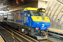
New York’s LIRR commuter rail runs 24 hours a day, 7 days a week. VRE could too.
Photo by flickr user Schaffner. |
Northern Virginia Congressmen Gerry Connolly and Jim Moran have introduced a bill authorizing (but not allocating money) to study and conduct preliminary engineering for suburban expansions of all of Virginia’s Metrorail lines, as well as an extension of Maryland’s Purple Line light rail project into Virginia, and unspecified “Metrorail capacity expansions” throughout the region.
While it’s good news that Northern Virginia’s Congressional representation has an eye towards transit (though Frank Wolf’s absence is notable), the bill is a reminder of the fact that for many people in this region the word “transit” is one-dimensional code for Metrorail. This is unfortunate, because while Metrorail is undeniably great, it isn’t the best solution to every transit problem we face. If we could could make the intellectual jump to accept a more diverse collection of transit modes, we would have the means to provide a better and more comprehensive regional transit network, faster and for less money.
Long time readers to BeyondDC have heard this before. I bring it up from time to time because it is such an important issue that it bears repeating.
The issue is that Metrorail is much, much more expensive to build than other transit modes such as commuter rail, light rail, streetcar, and BRT. Although MetroRail extensions to Woodbridge, Fort Belvoir and Centreville might be wonderful in those individual corridors, for about the same cumulative cost we could put light rail on every major arterial street in Northern Virginia and upgrade all the VRE lines to Metro-like service levels, with trains running frequently all day and on weekends.
Basically, if we were a little more open-minded with modes, we could have a transit system that put rail stations within walking distance of almost everyone in Northern Virginia for about the same cost as a couple of Metrorail extensions.
This isn’t to suggest that our historic investments in Metrorail were wrong. They weren’t. We need the high-cost, high-capacity core system to provide the backbone of our regional transit system. But with that backbone already in place, we can now do more with other modes. Metro is fabulous and we need it, but its reach is limited because it’s so expensive that we can’t build very much of it. Light rail and dramatically enhanced commuter rail don’t suffer from that problem.
Average Rating: 4.8 out of 5 based on 218 user reviews.
January 12th, 2011 | Permalink
Tags: BRT, commuterrail, government, lightrail, metrorail, streetcar, transportation

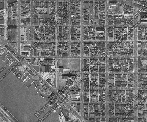
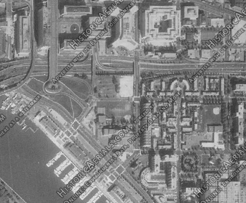
HistoricAerials.com is a really nifty web site. It’s a Google Maps-like page featuring aerial imagery from decades past. Its database includes images of Washington from several years dating back to 1949. It’s a fascinating way to watch neighborhoods change decade-to-decade.
The most visibly changed neighborhood in DC over the past 60 years has probably been Southwest, so I thought it would be interesting to look it up. Until the 1950s Southwest was a vintage rowhouse neighborhood, urban in every way and filled buildings from the 18th and 19th Centuries. Of course, mid-century planners could have none of that, so under the auspices of urban renewal it was almost completely bulldozed, and replaced by towers-in-the-park.
Here is Southwest in 1949, before it was “fixed”:
Here is the same view 14 years later, in 1963:
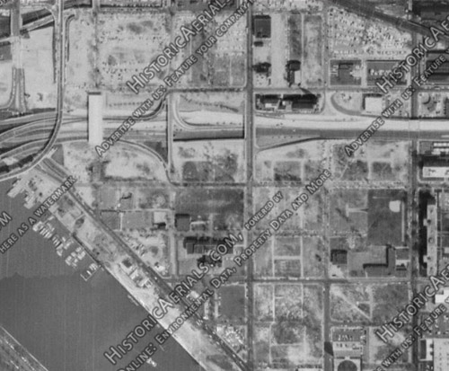
By 1979 the new Southwest was complete:
As if that weren’t sad enough on its own terms, things got even worse in other cities around the country. At least Southwest was rebuilt, albeit it in an inferior, too-suburban form. The same can’t be said for some neighborhoods in places like Detroit and Saint Louis, which through either misguided renewal efforts or simple neglect have gone from bustling to simply not there anymore.
Average Rating: 4.7 out of 5 based on 275 user reviews.
January 10th, 2011 | Permalink
Tags: galleries, history, preservation
Trolleys were once the bread and butter of urban transportation. As whole towns are now built around cars, whole towns were once built around streetcars. Although it’s been 49 years since the last trolley rolled down a Washington street, there remains a plenitude of vintage trolley infrastructure.
Everybody knows about the Dupont Circle trolley subway and the tracks on P street in Georgetown, but not everybody knows that the city is sprinkled with old trolley station buildings. Most trolley stops were no more substantial than contemporary bus stops, but at a few key locations the flag stop gave way to a depot building.
I know of four good ones.
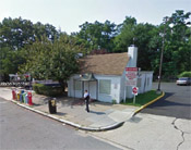
The first and most famous is actually outside the District of Columbia, at Glen Echo Park. There, day-trippers from the city rode out to an amusement park at the end of the line. It was Washington’s version of Coney Island. Although the crowds are long gone, most of the buildings at Glen Echo remain, including its marvelous Art Deco trolley station.
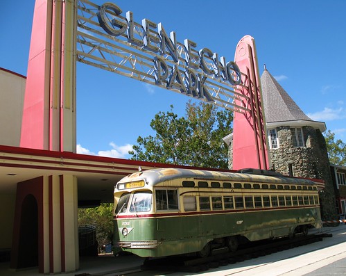
Photo by flickr user Mr. T in DC
Less splendid but nonetheless interesting, there are at least three in the District. From left to right in the images below (from Google Maps and Bing Maps): On Connecticut Avenue at Chevy Chase Circle, On 14th Street at Colorado Avenue, and on Calvert Street next to the Duke Ellington Bridge.
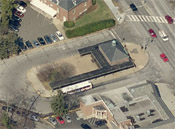 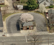 
Actually there’s some confusion over whether or not the Connecticut Avenue building was ever used for streetcars. Ironically, considering that it’s the largest of these four, it may have only been used for buses. All three of them are still used as important bus depots to this day.
Beyond these stations, entire books could be written about vintage trolley remnants in the area. There is so much to cover that one blog post can’t hope to capture anything but a tiny fraction.
Some remnants are well fairly well-known, like the light poles on the Klingle Valley Bridge, which are twice as tall as they need to be because they used to secure trolley wires.
Other remnants are all but forgotten. For example, one day a few years ago when I worked in the City of Fairfax, I found myself traipsing around a stream behind Route 50. I stumbled upon an old stone bridge deeply covered in brush. It turned out to be a bridge from the old trolley line that ended in Fairfax, but until I stumbled on it nobody – not even the city’s official historian – knew it was there.
Average Rating: 4.4 out of 5 based on 221 user reviews.
January 7th, 2011 | Permalink
Tags: galleries, preservation, streetcar, transportation
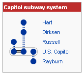
Metro isn’t the only subway system in Washington. In addition to the famous public system, there’s a small network of underground trams linking the various Congressional office buildings to the US Capitol.
The Capitol Subway has three lines, six stations, and seven railcars. The line to the Russell Building was the first, opening in 1909 (!). Other lines and extensions were added in 1960, 1965, and 1982.
Historically the subway has been open to visitors in certain situations, but a phone call to the Capitol Visitor Center informs me the current practice is that the only way for the public to get into the system is to be accompanied by Congressional staff.
There are plenty of pictures of the subway online. I found these two particularly illustrative ones at New York Social Diary, in a post about Washington by Carol Joynt.
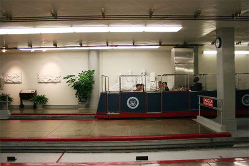
Capitol Subway railcar.
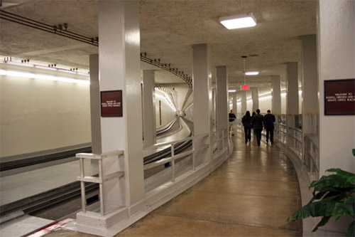
Tunnel.
Average Rating: 4.7 out of 5 based on 270 user reviews.
January 6th, 2011 | Permalink
Tags: galleries, transportation
In the early part of the 19th Century Georgetown and Alexandria competed as industrial port cities. Georgetown got a leg up in 1831 when the Chesapeake and Ohio Canal opened, which in the days before railroads was anticipated to become a major highway west. Alexandria, not wanting to be left behind, arranged for a spur canal to connect Alexandria with the more important canal in Georgetown. Only problem: The mule-pulled shallow draft canal boats couldn’t navigate the Potomac River. Thus it became necessary to build an aqueduct – a bridge over the river, filled with water to carry canal boats.
The Potomac Aqueduct Bridge opened in 1843 and connected Georgetown to the end of the Alexandria Canal, in present-day Rosslyn.
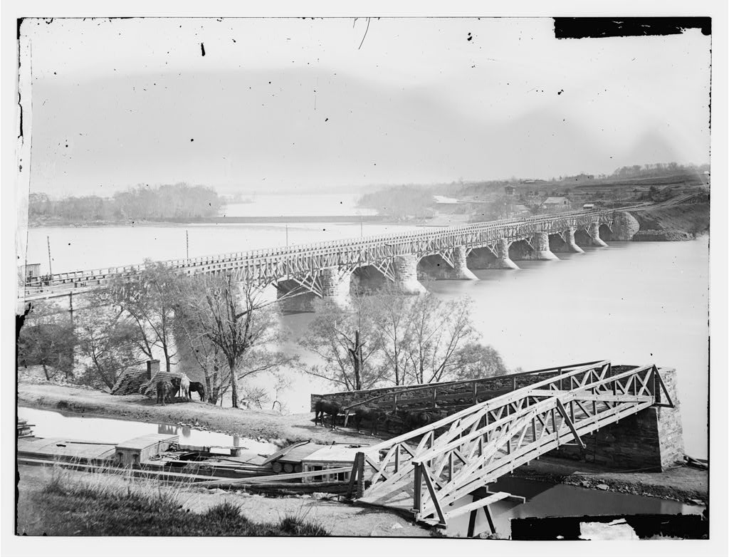
The first Aqueduct Bridge. Image from the Library of Congress, date uncertain.
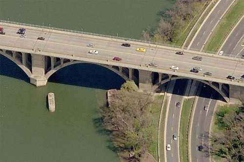
Decades later portions of the Aqueduct Bridge were rebuilt to accommodate trains and trolley cars, but the bridge itself stood for nearly a century, until it was demolished in 1923 to make room for the Key Bridge, which currently sits in its place.
Mostly demolished, that is. Portions of the old Aqueduct Bridge remain. You can even stand on it, if you care to.
The old abutments where the bridge met the DC and Virginia shores are still standing, and still perfectly visible if you know where to look.
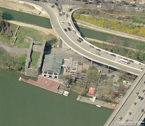
The DC abutment. Image from Bing Maps.
The VA abutment. Image from Bing Maps.
The Georgetown abutment in particular is easily accessible. It’s adjacent to the C&O Canal footpath just west of the Key Bridge, right next to the Potomac Boat Club. You can walk right up onto it and see the old aerial canal first hand.
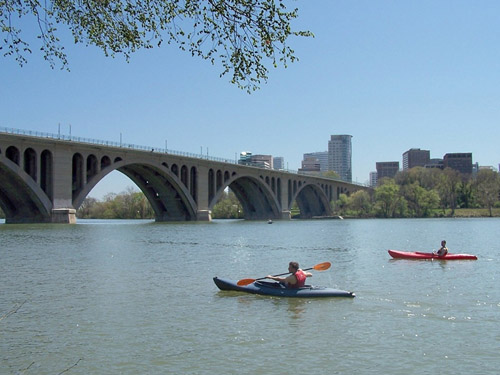
Those who do so are also awarded this splendid view of the river, Key Bridge, and Rosslyn skyline:
Average Rating: 4.5 out of 5 based on 163 user reviews.
January 5th, 2011 | Permalink
Tags: galleries, transportation
It’s a busy week for me. Unfortunately, I don’t have a lot of time for blogging. On that note, instead of a scholarly tome here is a picture of one of the DC area’s most interesting and oft-forgotten pieces of transportation infrastructure: White’s Ferry.

Photo from flickr user chriggy1.
White’s Ferry is located a little north of Leesburg, and is the only way to go directly from Montgomery County to Northern Virginia other than the American Legion Bridge. It’s a simple operation: The ferry is a slab of concrete that runs along a cable connected to both shores of the river. Riders walk (or more likely drive) onto the slab, which then crosses the river. The ferry runs continuously from 5 a.m. to 11 p.m. every day, and the crossing takes 5-10 minutes. It costs $4 one way or $6 round trip.
Average Rating: 4.4 out of 5 based on 198 user reviews.
January 4th, 2011 | Permalink
Tags: galleries, transportation
|
Media


Site
About BeyondDC
Archive 2003-06
Contact
Category Tags:
Partners
|