|
Special Features


Image Libraries


|
|
Blog
|

DC population change graph.
Image from Google.
|
Ten years ago, DC Mayor Anthony Williams famously set a goal of attracting 100, 000 new DC residents within a decade. Pundits scoffed, but the latest population estimates show we made it closer than most imagined possible.
The official US Census population estimate for DC in 2003 was 563, 384. The latest estimate for 2013 is 646, 449. That’s an increase of 83, 065.
In 2003, DC’s population was still shrinking. It had been about 569, 000 in 2002, and 572, 000 in 2000. Young single people had started flocking to some parts of DC, but families leaving for the suburbs still outnumbered people moving in and being born. Halting the decline seemed possible, maybe even likely, but growing by 100, 000 people in a decade seemed outrageously optimistic.
And to be fair, we didn’t quite make it. 83, 000 isn’t 100, 000. But it’s awfully impressive, awfully close. Far more than just about anybody thought possible.
DC’s population peaked at 802, 178 in 1950, then declined for the next half century. If today’s impressive growth rate continues into the future, we’ll catch up and surpass the 1950 high sometime in the mid 2020s.
We’ll have to keep up impressive growth to meet Mayor Gray’s goal of 250, 000 new residents by 2032.
 Cross-posted at Greater Greater Washington. Cross-posted at Greater Greater Washington.
Average Rating: 4.5 out of 5 based on 194 user reviews.
December 31st, 2013 | Permalink
Tags: demographics

Starting this week, WMATA is adding new service to several of the most important bus routes throughout DC, Maryland, and Virginia. Many lines will see more frequent buses, especially during nights and weekends.
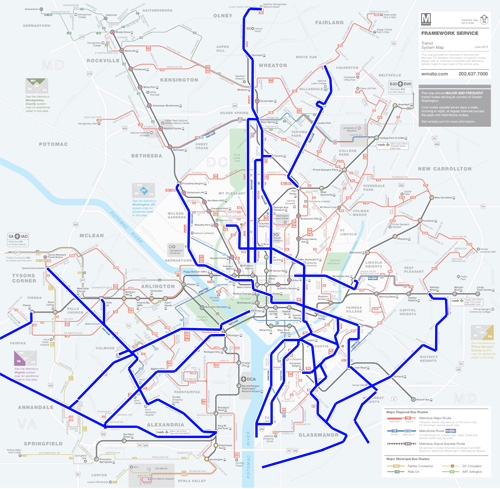
Map highlighting routes with added service.
In DC, more frequent weekend & evening buses are now running on nearly all of the major trunk bus lines, including 16th Street, 14th Street, Georgia Avenue, Pennsylvania Avenue, H Street, and U Street / Florida Avenue. Perhaps most importantly, Georgia Avenue’s route 79 MetroExtra service now runs on Sundays.
In Maryland, the New Hampshire Avenue, Georgia Avenue, and National Harbor lines are getting more buses. For Virginia, the biggest improvements are along Leesburg Pike and Little River Turnpike.
WMATA modifies its bus service a few times each year, but this round is particularly important because of DC’s WMATA’s Better Bus program, which is gradually improving the most important bus lines in the District.
The complete list of service changes includes dozens of changes all over the region. Most of them are positive, although a few routes here and there will see decreased service.
Cross-posted at Greater Greater Washington.
Average Rating: 4.7 out of 5 based on 271 user reviews.
December 30th, 2013 | Permalink
Tags: bus, transportation
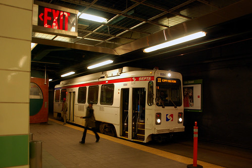
Last week, the first three of Metro’s new 7000-series railcars arrived at the Greenbelt railyard.
A 4th car is scheduled to arrive next week, after which Metro will begin testing them. The bulk of the new railcars won’t begin to arrive until several months later. Riders will begin to see them in service late in 2014.
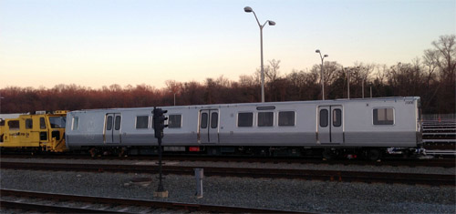
7000-series Metro car at Greenbelt yard.
Cross-posted at Greater Greater Washington.
Average Rating: 4.8 out of 5 based on 199 user reviews.
December 24th, 2013 | Permalink
Tags: metrorail, transportation
If you’re a responsible adult, you’ve already finished all your holiday shopping. If you’re like me, you’ve still got some to do. So here are some gift ideas for the urbanists in your life, all from brick-and-mortar stores in DC that you can visit today or tomorrow.
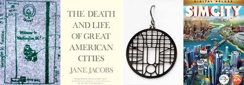
Fare card trivet, the Bible of urbanism, DC earrings, and SimCity computer game.
Get a book
You can’t go wrong with books, and most large bookstores have a shelf or two dedicated to architecture & city planning. The four urbanist books I always recommend are:
The Death and Life of Great American Cities by Jane Jacobs. It’s the Bible of urbanism, the seminal book on what makes a good city, and the singular most essential book in any urbanist library.
The Geography of Nowhere by James Howard Kunstler. By far the most accessible description of how suburbia happened, why it seemed to make sense at the time, and why it ultimately proved a disaster.
Suburban Nation by Andres Duany, Elizabeth Plater-Zyberk, and Jeff Speck. Like Death and Life, but more contemporary, and beautifully illustrated with simple maps & diagrams that help make the point.
Walkable City by Jeff Speck. Speck is a DC resident, a GGW contributor, and one of the best urbanist writers today. He collaborated on Suburban Nation, and then with Walkable City presented the hard data that backs up his claims.
Go to the National Building Museum gift shop
The National Building Museum focuses on cities and architecture, and has great gift shop. It’s open until 5pm Monday and Tuesday. They have DC street map earrings, Metro fare card trivets, city map ties, foldable paper Metrorail train cars, and all sorts of other cool stuff.
Get SimCity
If the urbanist you love is under 40, odds are he or she has played and loved the SimCity family of computer games. You can buy the latest version at any electronics or video games store.
Cross-posted at Greater Greater Washington.
Average Rating: 4.6 out of 5 based on 260 user reviews.
December 23rd, 2013 | Permalink
Tags: events, in general
In anticipation of the upcoming H Street streetcar, DDOT created this safety video that illustrates how drivers, cyclists, and pedestrians should act once the streetcar begins running.
Cross-posted at Greater Greater Washington.
Average Rating: 4.6 out of 5 based on 230 user reviews.
December 20th, 2013 | Permalink
Tags: streetcar, transportation
There’s a common misconception in some circles that bicycling is merely for recreation, as opposed to a legitimate transportation mode. Of course that’s wrong, cycling is often the most convenient way to get from point A to point B in a city. But why can’t transportation facilities be fun too?
According to Vancouver, they can.
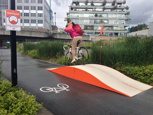
Vancouver “Whoopdeedoo.” Photo by Paul Krueger on flickr.
Cross-posted at Greater Greater Washington.
Average Rating: 4.7 out of 5 based on 266 user reviews.
December 19th, 2013 | Permalink
Tags: bike, fun, transportation
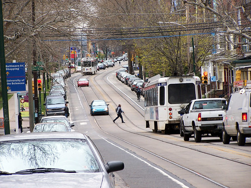
Philadelphia’s streetcar network is the largest and busiest in the mid-Atlantic. It has several interesting features, some of which can help inform the planning for DC’s growing system.
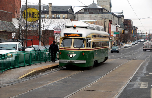
Philadelphia’s Girard Avenue trolley, with island platform.
Philadelphia calls its system trolleys instead of streetcars, because it’s vintage from the original trolley era. While Philadelphia did discontinue many of its original trolley routes, unlike DC they also kept many.
The Girard Avenue trolley line even uses vintage trolley vehicles, originally built in 1947. It also runs in a unique on-street arrangement, with tracks down the center of wide Girard Avenue, and stations in narrow floating medians.
The Girard Avenue trolley’s floating platforms.
The Girard Avenue arrangement is totally different than DC’s H Street layout, which uses a mixture of curbside and full median tracks.
Philadelphia’s center-running tracks result in fewer conflicts with parked or turning cars, which speeds the trolleys down their route. It’s almost-but-not-quite like a dedicated transitway.
Unfortunately, the platforms are too narrow to meet modern disability-accessible design guidelines. If DC were to use a similar arrangement, we’d need wider platforms and thus more street width.
Narrow platform on the Girard Avenue trolley line.
On narrower streets in West Philadelphia, trolleys still run in the center, with bike lanes between the tracks and a row of parked cars.
West Philadelphia trolley line.
The trolley subway
Five trolley routes that run on-street in West Philadelphia combine and then move into a dedicated trolley subway to speed through Center City. It’s a great way to maximize the efficiency of the system through its most dense and congested section, while still taking advantage of the flexibility of on-street operations further out.
13th Street trolley subway station.
DC once had a short trolley subway too, under Dupont Circle. Today, DC’s reborn streetcar plan doesn’t call for any. They’re hugely expensive, after all. But with the specter of Metrorail capacity constraints looming, and new DC subway lines under consideration, perhaps someday a streetcar subway could again be appropriate in DC.
What else is there?
I’ve never personally lived in Philadelphia, so my experience with its trolley network is fairly limited. I’m sure there are other interesting features. What did I miss?
Cross-posted at Greater Greater Washington.
Average Rating: 4.4 out of 5 based on 253 user reviews.
December 17th, 2013 | Permalink
Tags: galleries, streetcar, transportation, Uncategorized
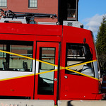
On Friday night, DDOT crews moved the first streetcar to H Street.
The last time streetcars ran on DC streets was January, 1962, just shy of 52 years ago. But don’t expect to catch a ride just yet. The streetcars must now undergo a series of on-street tests before passenger service can begin sometime in 2014.
Many city residents stopped by over the weekend to snap their own pictures. If you haven’t had a chance yet, it’s right there. You can go anytime.
Cross-posted at Greater Greater Washington.
Average Rating: 4.8 out of 5 based on 212 user reviews.
December 16th, 2013 | Permalink
Tags: events, streetcar, transportation
Imagine a generic urbanist. Someone who loves walkable, transit-friendly, mixed-use cities. Without knowing where this hypothetical person works, where their friends live, or how much money they might have, what single DC street corner would be the most ideal place for him or her to live?
Put simply, what’s DC’s most livable urban address?
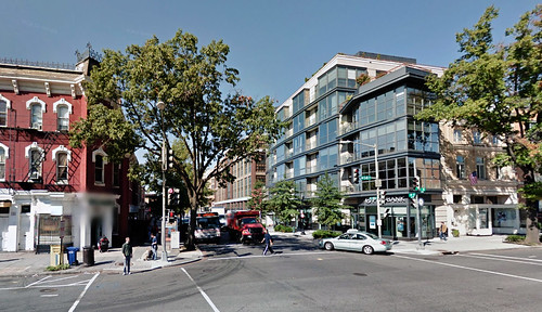
14th and P is the epicenter of everything. Image from Google.
The answer is 14th and P, NW.
There are thousands of great places to live all over the DC region, but to find the singular best corner, one has to apply some pretty strict criteria.
The ideal corner will be within easy walking distance of all 5 Metrorail lines. It will be on a major commercial main street, within one block of a supermarket. It will have bikeshare access, and it will be near a wide variety of shopping and dining amenities. There will be a park nearby, but it need not be quite as close as the supermarket.
The Metrorail requirement eliminates everything but Downtown and the southern end of Dupont & Logan. The Capitol Hills and Columbia Heights of the world are wonderful, but comparatively less well-connected.
The major grocers in that area include the Safeway at 5th and L, the new Giant at O Street Market, the Safeway at 17th and Corcoran, and the Whole Foods at 14th and P.
5th Street and O Street have fewer other amenities nearby. Chinatown is close, but not right there. They’re less desirable than the other two.
Corcoran Street has all the amenities, but it’s on the very outer edge of walkable from the Orange & Blue Lines.
That leaves P Street. It’s at the middle of all 5 Metro lines, on 3 major bus routes, has a bikeshare station, and is within a block of the best cycletrack in the city. It has a grocery store, a CVS, a hardware store, and tons of restaurants right there. Logan Circle park is a block away. All the riches of the 14th Street corridor are in easy reach. It’s perfect.
And that’s why 14th and P is the city’s most livable urban corner. Others are nice, others may be better for you given your circumstances, but 14th and P is the prime address.
But what do you think?
Cross-posted at Greater Greater Washington.
Average Rating: 4.8 out of 5 based on 281 user reviews.
December 12th, 2013 | Permalink
Tags: land use, question
NASA’s GOES satellite took this amazing picture of today’s storm at 9:45 this morning. The DC area is obscured by snow and clouds, obviously, but you can see the storm covering the whole mid-Atlantic north of Florida.

Image from NOAA/NASA GOES Project.
Average Rating: 4.5 out of 5 based on 203 user reviews.
December 10th, 2013 | Permalink
Tags: environment
|
Media


Site
About BeyondDC
Archive 2003-06
Contact
Category Tags:
Partners
|