Before the rise of air conditioning and cars, cities in the south were as urban and walkable as those in the north. For some reason those older southern cities stagnated in the 20th Century, and were passed over by more suburban counterparts, but they still have high quality cores.
I spent the first two days of 2013 in the twin capitals of historic southeast urbanity, Savannah, GA and Charleston, SC. Although they’re both small by 21st Century standards, they were urban behemoths of early America. In the year 1800 Charleston was the 5th largest city in the country, and Savannah the 21st. The equivalent metro areas as of 2010 are Philadelphia and Denver. That’s how important these cities were.
Today they’re odd places. They have walkable historic cores that seem like they should be the center of major metro areas, but outside their cores there are almost no suburbs, because neither had the sort of 20th Century boom that’s defined other southern cities
Savannah
I found Savannah to be very much like a larger version of Alexandria. It’s a classic river city, with an industrial waterfront downtown, and a grid behind.
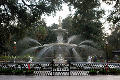
Savannah’s famous squares are the urbanist highlight of the city. They’re wonderfully scaled, big enough to offer a variety of public spaces and a reasonable escape, but small enough to be easily accessible from surrounding blocks.
The city is also filled with alley houses, from tiny shacks that must be very cheap, up to luxurious carriage houses. With its public spaces and alleys, it’s easy to see how Savannah was a big inspiration for the new urbanists.
Savannah is also home to a wireless electric streetcar, but unfortunately it’s oriented towards tourists and only runs a couple of days per week.
Charleston
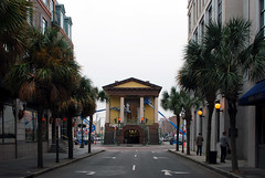
Charleston is just as urban and walkable as Savannah, but otherwise looks completely different. It’s a southern Boston or lower Manhattan, with narrow medieval streets twisting in every direction. And whereas Savannah’s downtown fronts on the city’s waterfront, downtown Charleston is in the interior of the city, blocks from the industrial shore.
Charleston is clearly a wealthier place, and seems to have a more active economy besides tourism.
While Charleston doesn’t have anything so grand as Savannah’s squares, it does have a great market house. Like a bigger and more flexible version of Eastern Market, Charleston’s market would make a fantastic addition to any city. The front section is more permanent and filled with shops oriented to tourists, but the more interesting back section is simply stalls, ready to be filled by any kind of temporary craft or food vendors available.
Both cities had a lot of cyclists, but not much cycling infrastructure, and both have seemingly unimpressive bus networks.
Average Rating: 4.8 out of 5 based on 156 user reviews.
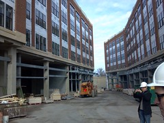
Monroe Street Market will be Brookland’s first sizable transit oriented development. It’s immediately adjacent to the Metro station, and will have a great mix of shops, apartments, artist studios, and community spaces. It’s exactly the type of development smart growth advocates like.
The main plaza of Monroe Street Market will be called the Arts Walk. I was lucky enough to get a brief tour of its construction this past weekend. Here are a few pictures.
The future Arts Walk.
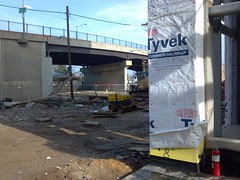
Where the Arts Walk meets the Michigan Avenue overpass. A fountain will be built in front of the blank wall.
Brookland Metro, right across the street.
The tour guide describes how artist studios will be incorporated.
Average Rating: 4.9 out of 5 based on 300 user reviews.
From 1949 until 1962, DC Transit trolleys ran in a subway under Dupont Circle. Those subway tunnels are still there, boarded up and unused. I got a tour of the old tunnels yesterday, and detailed the trip with a set of pictures.
You can preview the pictures using the slideshow below, but the best way to see them is on flickr itself, where you’ll get a full description of each one. If you use flickr directly, you can navigate to subsequent pictures using the thumbnails on the right side of the page. If you look at each picture in order and read each description, you’ll pretty much be getting the same tour I got in person.
Average Rating: 4.5 out of 5 based on 261 user reviews.
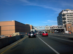
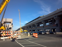
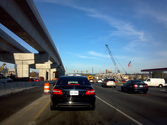
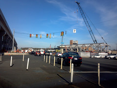
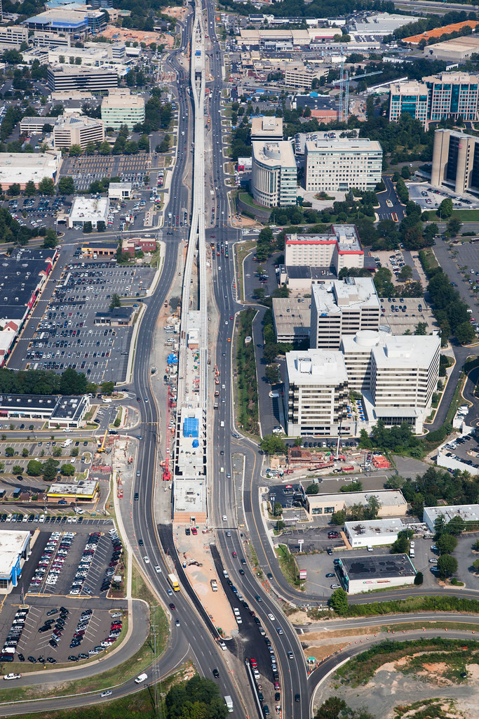
I’ve spent the last couple of days at the Virginia Governor’s Transportation Conference in Tysons Corner, which has given me a chance to see the Route 7 portion of the Silver Line up close.
Construction is moving along rapidly, which is great. But as the line takes shape, it’s also becoming clear just how difficult it will be to transform Tysons into a walkable urban place. Route 7 is so wide that these Metro stations are looking very much like Vienna and Dunn Loring. That’s not a deal-breaker (there’s a huge TOD under construction at Vienna right now), but it’s certainly less ideal than the tightly knit Rosslyn-Ballston corridor, which Tysons seeks to emulate. Highways punching through the middle of cities are bad, and Route 7 in Tysons will be no exception.
Here are a few photos, snapped while stopped amidst traffic on Route 7.
Greensboro Station.
Spring Hill Station.
Elevated rail line, near Spring Hill Station.
Spring Hill’s pedestrian bridge, not yet installed.
Average Rating: 5 out of 5 based on 292 user reviews.
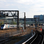
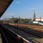
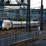
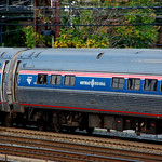
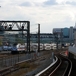
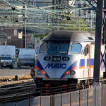
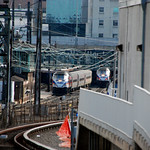
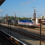
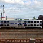
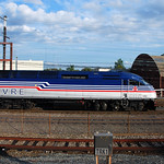
The platform at NoMa Metro station is one of the best places in the United States to see passenger trains. Since NoMa is above ground just north of Union Station, visitors can see a steady stream of Amtrak, MARC, and VRE trains coming and going from Union Station. And with the US Capitol dome in the distance, there’s also the bonus of a nice setting.
A couple of weeks ago I happened to be there around rush hour, so I stuck around for 15 or 20 minutes and got a bunch of pictures. A few are shown here, with the full set of 24 on flickr.
Acela.
Amtrak Regional.
MARC.
VRE.
Average Rating: 4.6 out of 5 based on 216 user reviews.
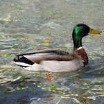
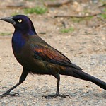
There are hundreds of thousands of birds in Washington, DC. It is virtually impossible to be outside and not see several of them. BeyondDC is hardly a nature blog, but birds are such a fact of life in cities that it’s worth being able to identify the most common ones.
So here’s a quick guide of the most frequently seen birds in DC.
Pigeons. Everybody knows pigeons. Photo by dragontoller.
Sparrow. The little brown birds you see everywhere. Photo by Mr T in DC.
Starling. “Washington Starlings” would have been a great name for a baseball team. Photo by Shawn McCready.
Robin. Very common in suburbs, a little less so in the city. Photo by Lucina M.
Washington’s growing fleet of water taxis are useful as transportation, but they’re also a fun and unique way to see the city. I used an American River Taxi to travel to a Nationals game a few weeks ago, and photographed the trip for posterity.
ART ferries sailing to the ballpark pick up passengers at Washington Harbor, in Georgetown. Boats pull directly up to the boardwalk, and passengers simply walk straight on.
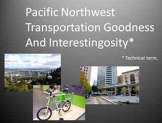
Last year about this time I visited Seattle, Portland, and Vancouver. I prepared a slideshow of transportation photos from the three cities to share with coworkers. It’s essentially a tour of rail, bus, and bike infrastructure within each city. Why not share it here too?
Click the image to download a pdf of the slideshow. It’s about 16 Mb. If you just want to see the photos in flickr without commentary, here they are.
Click to download pdf.
Average Rating: 4.8 out of 5 based on 155 user reviews.
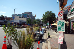
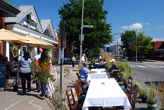
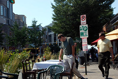
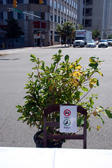
For Park(ing) Day today, Arlington converted a block of Wilson Blvd parking spaces into a row of outdoor cafe seating. The setup will be in place this evening until around dusk.
Here are some pictures:
Average Rating: 4.9 out of 5 based on 190 user reviews.