|
Special Features


Image Libraries


|
|
Blog
Washingtonians hoping to catch a bus in 1975 consulted this friendly-looking hand-drawn map. Charming as it may be, the map has no lines. Rather, designers wrote the name of each bus route over and over along its path through the city.
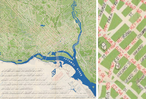
Image from DDOT.
Transit riders and cartography experts can’t fault the map designers too much. It was more challenging to illustrate detailed networks before the days of computers, and even in recent years some WMATA maps have been just as hard to follow.
Legibility aside, the map actually includes some very progressive elements considering its vintage. According to the legend, it only shows “all-day routes with frequent service, ” an incredibly useful idea that’s picked up a lot of steam in the past five years.
Other progressive elements shown on the map include bike paths, although the Mount Vernon and Rock Creek trails appear to be the only ones, and much of its text is translated into Spanish.
The map also includes a fun vignette of the Metrorail system, which had yet to open but was less than a year away.
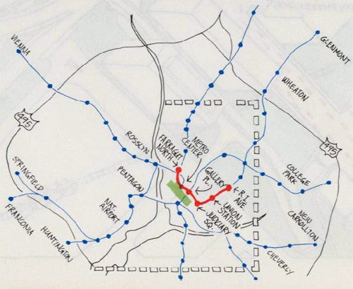
Image from DDOT.
On the other hand, some things never change. The legend for the Metrorail vignette notes Metro’s first phase was scheduled to open later in 1975. In actuality it didn’t open until 1976.
Finally, there are several other vignettes on the reverse side:
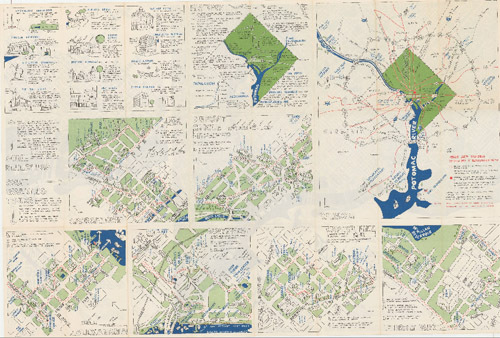
Image from DDOT.
Architecture firm John Wiebenson & Associates produced the map for the Bicentennial Commission of the District of Columbia.
 Cross-posted at Greater Greater Washington. Cross-posted at Greater Greater Washington.
Average Rating: 4.4 out of 5 based on 270 user reviews.
March 13th, 2015 | Permalink
Tags: bus, fun, history, maps, transportation

I’m on vacation in Europe until the 24th. Each weekday until my return there will be a brief post about some feature of the city I’m visiting that day.
Without a doubt, Paris is home to the world’s most successful urban renewal scheme. The Haussmann Plan was carried out primarily between 1853 and 1870, and significantly contributed to the creation of Paris’ most famous boulevards and its iconic architectural style.
Under the guidance of city planner Baron Georges-Eugène Haussmann, large sections of Paris were demolished and rebuilt along wider, grander, straighter boulevards. And new building regulations were adopted that delineated the height and form of buildings.
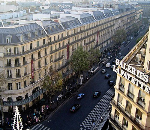
Boulevard Haussmann, with its strictly regulated buildings.
Photo by Thierry Bézecourt via Wikepedia.
Average Rating: 4.6 out of 5 based on 220 user reviews.
March 19th, 2014 | Permalink
Tags: architecture, history, History of cities, urbandesign
I’m on vacation in Europe until the 24th. Each weekday until my return there will be a brief post about some feature of the city I’m visiting that day.
Paris’ Vélib’ bikesharing network wasn’t the first in the world, nor even the first with modern characteristics like RFID membership fobs. But it’s the system that made bikesharing famous worldwide. It’s the system that exported the idea around the globe, following its 2007 launch.
Today, Vélib’ has about 20, 000 bikes. That makes it the largest bikeshare system in the world outside of China (where the city of Wuhan’s network has a staggering 90, 000 bikes). For comparison, New York has somewhere between 4, 000 and 6, 000.
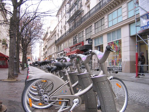
Vélib’. Photo by Aurel via flickr.
Average Rating: 4.6 out of 5 based on 163 user reviews.
March 18th, 2014 | Permalink
Tags: bike, history, transportation
I’m on vacation in Europe until the 24th. Each weekday until my return there will be a brief post about some feature of the city I’m visiting that day.
Versailles was the seat of the French monarchy for over 100 years, through the bulk of the 18th Century. Its baroque design had a major influence on Pierre L’Enfant’s design for Washington, DC.
This photo shows the palace and the Place d’Armes, but doesn’t it look an awful lot like the westward view from the US Capitol?
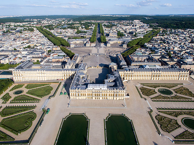
Versailles. Photo by Lionel Allorge via Wikipedia.
Average Rating: 4.9 out of 5 based on 227 user reviews.
March 17th, 2014 | Permalink
Tags: history, urbandesign
Today in transit nerdery, take a look at this Capital Transit articulated bus from 1948.
According to the original description, this is a demonstration run of a bus model Capital Transit never actually used for passengers. The photo shows the Calvert Street turnaround, which is still used today.
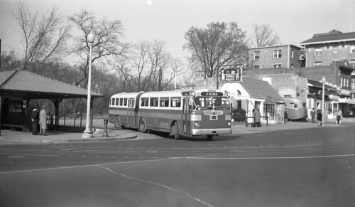
Original photo by Robert S. Crockett. Copied by flickr user rockcreek.
Average Rating: 4.7 out of 5 based on 172 user reviews.
November 26th, 2013 | Permalink
Tags: bus, history, transportation
WMATA’s Metro Forward Facebook page has a fun set of Metrorail construction pictures, dating from the mid-1970s. They’re a fascinating look back at a wholly different Washington.
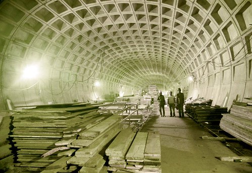
Archives in 1975. Photo from WMATA.
The most interesting may be a 1974 picture of Gallery Place under construction. What’s now the Verizon Center is a dirt patch and a collection of holes.
But my favorite is probably the one of Archives station in June, 1975, pictured above. In the picture, workers have yet to add the tracks, platforms, or mezzanines, so the vaulted ceiling runs uninterrupted for the entire length of the station. It looks so much more voluminous!
Cross-posted at Greater Greater Washington.
Average Rating: 4.9 out of 5 based on 243 user reviews.
September 24th, 2013 | Permalink
Tags: history, metrorail, transportation
|
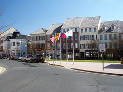
Main Street, Kentlands |
It’s been 25 years since development started at Gaithersburg’s Kentlands, America’s first year-round new urbanist community. With a quarter century of experience under our belt, not to mention a major shift in American development patterns, what have we learned?
When new urbanism hit the big time in the late ’80s and early ’90s, central cities were still declining, and suburbs were still focused around enclosed shopping malls. Generations of Americans had grown up driving around the suburbs, thinking of urban places as crime-ridden ghettos.
New urbanism changed all that. Wherever a new urbanist neighborhood opened, a nice-looking and safe walkable urban place suddenly became accessible to the suburban masses, many of whom had never had one before.
New urbanism reintroduced Americans to the concept of urban living. And as recent history tells us, once we learned urban living was an option, people flocked to it.
New urbanism’s strength is its weakness
But all walkable communities aren’t created equal, and the very thing that made new urbanism initially successful also became its most limiting weakness.
In older urban areas, new urbanist development is indistinguishable from well-designed regular infill. So although new urbanism has many infill projects to its name, the term is more strongly associated with suburban development like Kentlands, where it’s more distinct.
Those suburban new urbanist communities have usually turned out to be internally walkable, but poorly connected to their auto-oriented surroundings. Without the critical mass of a huge walkable city surrounding them, they hit a ceiling. Residents can walk to a corner store and a few cafes, but most of them still need cars to get to work, or really to go anywhere more than a half mile away.
So new urbanism boomed, but those who bought into the concept of urban living quickly deduced that larger and older urban communities offer a superior experience. Kentlands is nice, but compared to places like DC, Arlington, or Silver Spring it’s still relatively isolated, homogeneous, and car-dependent.
Thus, in a twist of fate, new urbanism’s main lasting benefit may be that it’s a gateway for suburbanites to become urbanites — a baby step towards regular urbanism. A necessary step, to be sure, but one quickly passed by.
We do still need new urbanism
Despite the fact that regular urbanism is back, and that new urbanism is no longer the progressive cutting edge of city planning, we still need it in the suburbs.
New growth at the suburban fringe will continue to happen, after all. It always has and it always will; even Dupont Circle was once rural. So we will need a steady stream of new suburban places that are more walkable, more mixed-use, less dependent on the 20th century highway paradigm that has failed so badly. New urbanism remains ideally suited for that purpose.
Regardless of whether or not it’s true that we still need new urbanism to build good cities, we clearly still need it to build better suburbs.
Cross-posted at Greater Greater Washington.
Average Rating: 4.6 out of 5 based on 175 user reviews.
August 21st, 2013 | Permalink
Tags: history, The New America
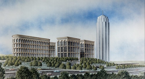
National Harbor was originally going to be called Port America, and it almost included a skyscraper that might have been taller than the Washington Monument.
By 2008 when the first part of National Harbor opened, the concept of suburban town centers was tried and true. But developers have been trying to build a town center there since the mid 1980s. When they started, it was the most progressive of ideas.
The original plan for Port America dates from 1987. It would have included a neo-classical mixed-use town center in the same place as National Harbor’s waterfront, plus a large office park on the adjacent property that is now under-construction to become an outlet mall.
The office park would have included a 52-story trophy office tower. It would very likely have risen above the 555-foot Washington Monument, and definitely would have dwarfed the DC region’s current tallest office building, Rosslyn’s 384-foot 1812 North Moore.
 |
 |
 |
 |
| Port America. All images from Burgee-Jonhson. |
Cross-posted at Greater Greater Washington.
Average Rating: 4.6 out of 5 based on 263 user reviews.
August 9th, 2013 | Permalink
Tags: development, history, urbandesign
I absolutely love exploring the world with Google Street View. Oh sure, real life is infinitely better, but I can’t afford plane tickets to all the places I can get lost in with Street View.
Yesterday I discovered Street View covers Midway Atoll, of Battle of Midway fame. The island was used for decades by the US military but is now depopulated except for a few visits per year by researchers. But all the buildings are still there, not to mention about 440, 000 albatross birds.
It’s fascinating, and a little creepy. Take a look.
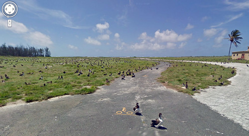
Every black smudge you see in this picture is a 3-foot bird. And yes, that’s a bike path.
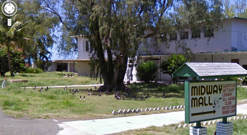
Downtown Midway, abandoned.
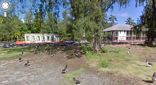
Ruins are everywhere, but the birds don’t mind.
Average Rating: 4.4 out of 5 based on 173 user reviews.
July 19th, 2013 | Permalink
Tags: bike, fun, history, preservation, transportation
Back in 1926, a robust network of steamship routes ferried passengers up and down the Chesapeake Bay and Potomac River. This map shows how part of that network functioned.
The map only shows lines that served Baltimore, so it’s probably a safe bet that DC had more than just the one.
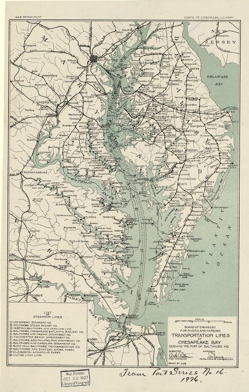
Public domain image from the US Library of Congress.
Originally produced by US Army.
Average Rating: 4.8 out of 5 based on 205 user reviews.
July 10th, 2013 | Permalink
Tags: history, transportation
|
Media


Site
About BeyondDC
Archive 2003-06
Contact
Category Tags:
Partners
|


