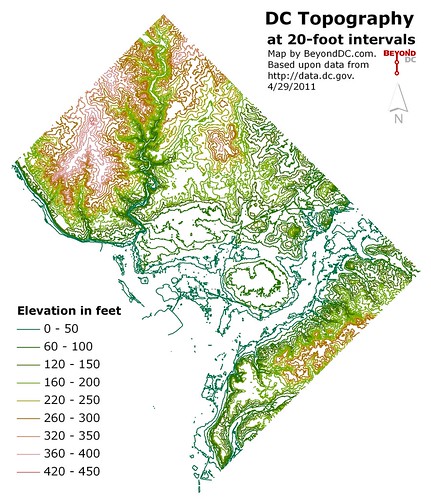
Last in this week’s series of simple DC maps: city topography.
Interesting features that are clearly visible include Capitol Hill, Rock Creek gorge, the Anacostia bluffs, the floodplain escarpment at the north end of the L’Enfant city, the heights of Tenleytown (culminating at Fort Reno for DC’s highest point), and a large hill near the US Soldiers’ Home that I’m sorry to say I can’t name.
Click the map to enlarge.
Average Rating: 4.4 out of 5 based on 232 user reviews.
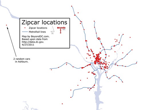
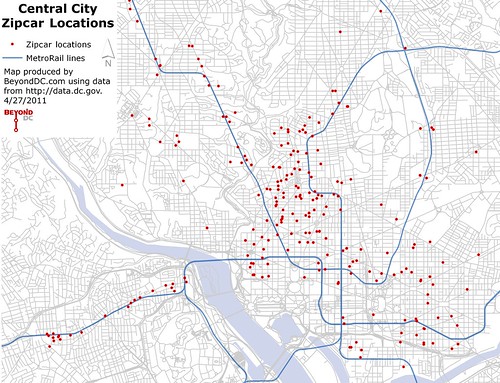
Another entry in this week’s series of maps from the District’s GIS data catalog: Zipcar locations. A regional map at left, with the urban core at right. Click either for larger versions.
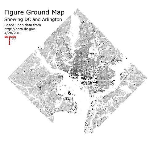
Note that to keep these maps simple I’m not putting much on them in regards to geographic reference points. I’m assuming that most readers are familiar enough with regional geography to read the maps without street labels or other detailed reference material. That information could be added, but I’m interested in seeing these with as little visual clutter as possible, and I assume that at least some of you are interested as well.
Average Rating: 5 out of 5 based on 293 user reviews.
The District’s GIS data catalog is a treasure trove of interesting information. I’ll continue to post maps produced from that data the rest of this week. This morning: The MetroBus system, shown alone and geographically accurate.
Geographically accurate MetroRail maps are pretty easytocomeby, but I’ve never seen the MetroBus system all on one page, stripped of other detail. Here it is:
The official DC Zoning and Comprehensive Land Use maps are incredibly detailed and useful tools that serve specific, necessary functions. They’re also incredibly complex and difficult to read at a glance. I wanted to see a map that showed DC’s land use in the very simplest terms, to know where the commercial streets are, to see how downtown might reasonably expand, and to see where redevelopment is most likely (commercial properties are more likely to redevelop than residential ones).
Therefore I produced the following map, using data downloaded from the DC GIS Catalog. It shows predominantly commercial areas in red, predominantly residential ones in yellow, and everything else in gray.
For those interested in Washington as a living and working city, this is the city at just about its most bare.
Average Rating: 4.6 out of 5 based on 253 user reviews.
How do you fit a parking garage opening into a building while maintaining its architecturally detailed, pedestrian-friendly facade? Like this, from a building in San Francisco’s Haight-Ashbury neighborhood.
The Metropolitan Washington Transportation Planning Board reported Wednesday that there will be a third round of the federal government’s TIGER transportation grant program.
The popular and extremely competitive grants can be used for almost any transportation idea, provided applicants make the case that their project deserves funding.
The recently-passed federal budget deal includes $528 million for a new installment of the program, which is expected to be announced formally along with a solicitation for applications some time in early summer. Submissions would most likely be due in late summer, with funding decisions probably coming in winter.
It’s expected that the new program will very closely mirror last year’s $600 million version, including the 80-20 federal-local match requirement and the merit-based project scoring. One expected difference will be that the new program may exclude planning and design projects in order to focus exclusively on construction and implementation.
The Washington region was awarded a grant for bus improvements in round one, and applied for but didn’t receive a grant for bikesharing in round two. However, the TIGER II bikesharing application was apparently one of the highest-scoring nationally not to receive funding, so it might be prudent to simply try the same thing again.
In any event, this will be a major program to watch. The TPB will almost certainly put forth a regional application, and most of the local jurisdictions will probably apply for projects separately as well.
One of the frequently cited differences between BRT and rail is that rail is much better at inducing development around stations. Traditionally this has been called a weakness of BRT and a strength of rail, but I wonder if BRT proponents shouldn’t re-frame the difference as a positive.
On the other hand, this is dangerous thinking. The long term effects of giving poor communities a second class transit system while giving rail to wealthier communities could potentially be disastrous. Certainly there is a social justice question about which is more fair. And of course, there is widespread debate about the positives and negatives of gentrification to begin with. It shouldn’t be taken as a given that it’s always bad. If there’s never any gentrification, poor areas become ghettos and that isn’t good for anyone.
But if the key to transit planning is to match the service to the needs of the corridor, it could be true that BRT’s inability to induce development might be a selling factor in some cases.
Average Rating: 4.6 out of 5 based on 187 user reviews.
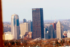
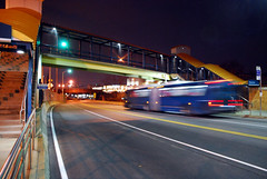
Pittsburgh is an under-appreciated urbanist’s playground. Its collection of vintage walkable neighborhoods, unique transportation infrastructure, and its beautiful natural setting make it one of the most interesting cities in America. I was there two weekends ago to and took a slew of pictures, in two categories:
The transportation set is particularly interesting, because Pittsburgh has such a varied collection of transit infrastructure. They have vintage pre-war trolley lines that have been converted to modern light rail and run in a subway downtown, they have three major busways and some interesting on-street bus lanes, and they have two funicular incline railroads, providing transit up and down the steep slopes of Mount Washington.
I definitely recommend taking a look. If you prefer to view pictures directly in flickr, they are organized into six sets in BeyondDC’s Midwestern US photo collection.
Average Rating: 4.6 out of 5 based on 188 user reviews.


