The winter solstice came and went at 6:12 am this morning. Shockingly, the world didn’t end.
I’ll be on holiday until a few days into the new year, so this is probably the last blog post of 2012. I’ll continue to tweet through the holiday, so see you there.
DOOM!.
Average Rating: 4.6 out of 5 based on 290 user reviews.
On a day when Maryland released renderings of the Purple Line subway in Bethesda, and Arlington got specific on streetcar vehicles, the biggest urbanist news is probably that the Department of Defense has relaxed security rules that effectively outlawed using urban buildings for DoD offices.
After 9/11 the Pentagon established strict security standards for DoD offices. Among other things, those standards required large setbacks from the street, which meant that offices couldn’t locate in the most central urban areas, or in pedestrian-oriented buildings. This pushed a lot of federal workers out of Metro-accessible offices in places like Rosslyn and Crystal City out to more suburban locations.
The new rules, which were announced on December 7 but didn’t hit the public news until yesterday, relax the rules so that DoD offices only have to comply with the same design standards as federal office buildings leased by civilian agencies. This means they can once again locate in urban buildings.
Not only does this eliminate a major advantage that suburban office centers had over urban ones, it also reduces the pressure to build bad suburban buildings in urban places that should be walkable.
Good news.
Average Rating: 4.9 out of 5 based on 175 user reviews.
Flickr user davidwilson1949 has a collection of over 100 historic transit pictures from the DC area, dating from the 1970s forward. Fun and fascinating stuff. Here are two of his images:
Articulated Metrobus, 1979.
Ride-On bus, 1979.
Average Rating: 4.6 out of 5 based on 253 user reviews.
From 1949 until 1962, DC Transit trolleys ran in a subway under Dupont Circle. Those subway tunnels are still there, boarded up and unused. I got a tour of the old tunnels yesterday, and detailed the trip with a set of pictures.
You can preview the pictures using the slideshow below, but the best way to see them is on flickr itself, where you’ll get a full description of each one. If you use flickr directly, you can navigate to subsequent pictures using the thumbnails on the right side of the page. If you look at each picture in order and read each description, you’ll pretty much be getting the same tour I got in person.
Average Rating: 5 out of 5 based on 279 user reviews.
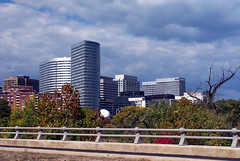
Rockville’s awful parking lot, and the development that will replace it.
For literally decades, downtown Rockville’s most central block has sat empty, used only as a parking lot. It’s been a huge hole in the city’s urban fabric, separating the area near Rockville Metro station from the more vibrant Town Square. Now, after multiple failed attempts, it is finally, finally, being developed.
And with this property, the most visible sign of Rockville’s failed 1960 urban renewal will be erased.
Back in 1960, Rockville was transitioning away from its historic role as a sleepy county seat, and into a booming post-war suburb. City leaders fully embraced the notion that walkable urban places were obsolete, and approved an urban renewal plan that bulldozed 111 buildings covering 47 acres – almost all of Rockville’s historic downtown.
Like countless such plans from that era, this one was a disaster. A few mostly car-oriented buildings were constructed, including the short-lived Rockville Mall, but much of downtown remained empty.
It wasn’t until New Urbanism started taking hold in the 1990s that Rockville once again began thinking about its downtown as a downtown, instead of a glorified strip mall and office park.
Since then Rockville has had many successes. The Regal Theater opened, a grand new courthouse was built, and of course, the impressive new Town Square redefined the center of downtown. But in all that time, one key property has failed to redevelop, despite repeated attempts.
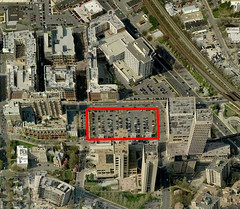
Town Center parking lot
Ever since the 1960 mass bulldozing of downtown, the block bounded by Middle Lane, Montgomery Avenue, Maryland Avenue, and Monroe Street, has been vacant of buildings. It’s the central block in Rockville’s downtown street grid, and marks the transition between the remaining urban renewal era highrises to the south, and the new Town Square to the north.
Arguably, it’s the most important single block in Rockville, and it’s been nothing but a parking lot for decades. In 2009 I named it the 5th most offensive parking lot in the Washington region, and the #1 worst outside of the District.
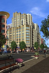
In 1994 the city worked with developers to plan a huge complex of office towers, including what would have been the tallest building in the city. The proposal floated around until the dot com bust soured the upper Montgomery County office market. By the turn of the millennium, the proposal was dead.
Then in 2005 the City of Rockville approved a new mixed-use redevelopment for the property, with somewhat shorter buildings. But development never got started, and when the recession hit those plans were once again tabled.
But now it appears that 2005 proposal has been dusted off and is ready to be built. The developer has a tenant and bank financing, which had always been the major holdups.
7 years after project approval, 18 years after the first proposal, and 52 years after urban renewal ruined Rockville, downtown is finally being stitched back together.
Upon seeing the property fenced off for the start of construction last week, Thisisbossi said it best on Twitter: FINALLY.
Oh sure, in 2012 we’ve got cycle tracks and bikesharing and all sorts of cool stuff, but in 1895 it was all the rage to race your pennyfarthing down the steps of the US Capitol.
And by “all the rage, ” I mean I found one picture of that on the internet.
Original source unknown. Image sourced from imgur.
Average Rating: 4.5 out of 5 based on 178 user reviews.
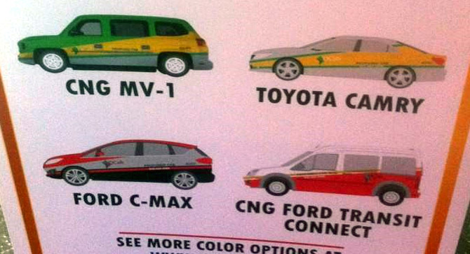
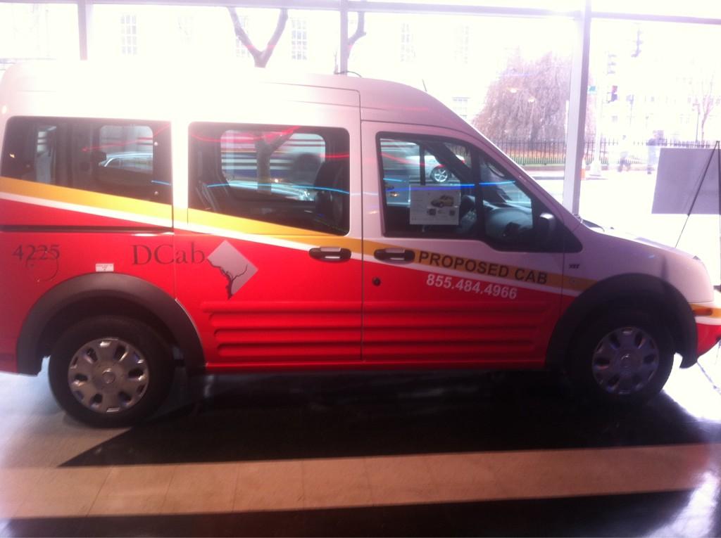
DC has unveiled 4 options for a uniform citywide taxicab paint scheme. DCist’s Martin Austermuhle is live-tweeting the presentation.
Here they are:
Photo by Martin Austermuhle.
Back in 2009 I said that by not having a uniform color scheme, DC is losing out on an important branding opportunity. New York’s yellow taxis are one of the strongest images associated with that city. Since DC has as many cabs per capita as New York, the same could be true here.
Red is the natural choice. We want something distinctly different from New York, and clearly associated with DC. Since red is already the primary color of DC Circulator, Capital Bikeshare, and the future DC Streetcars, it makes sense to use the same colors on taxis. Doing so evokes a uniform brand for the city’s entire transportation system, across multiple modes.
Photo by Martin Austermuhle.
Two of the options released today use red. One of them, pictured here, uses the same shade as Circulator and Bikeshare, and includes a similar yellow stripe down the side. Of the 4 options, this is the best. But it would be better with red and white reversed, so that red is the dominant color.
Ideally I’d prefer a simple solid red, with maybe some yellow highlights. But since there are a lot of solid red private cars out there that aren’t taxis (which isn’t a problem for New York’s yellow), I’m willing to concede that something a little more complex is necessary here. If we want red, it may need to be multi-colored.
Although it’s not online yet, officials say there will be a survey on dctaxi.dc.gov asking for feedback. After that, the city will presumably pick a livery and set a timeline for adoption.
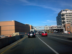
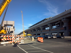
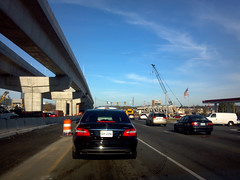
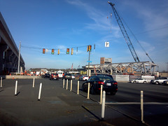
I’ve spent the last couple of days at the Virginia Governor’s Transportation Conference in Tysons Corner, which has given me a chance to see the Route 7 portion of the Silver Line up close.
Construction is moving along rapidly, which is great. But as the line takes shape, it’s also becoming clear just how difficult it will be to transform Tysons into a walkable urban place. Route 7 is so wide that these Metro stations are looking very much like Vienna and Dunn Loring. That’s not a deal-breaker (there’s a huge TOD under construction at Vienna right now), but it’s certainly less ideal than the tightly knit Rosslyn-Ballston corridor, which Tysons seeks to emulate. Highways punching through the middle of cities are bad, and Route 7 in Tysons will be no exception.
Here are a few photos, snapped while stopped amidst traffic on Route 7.
Greensboro Station.
Spring Hill Station.
Elevated rail line, near Spring Hill Station.
Spring Hill’s pedestrian bridge, not yet installed.
Average Rating: 4.4 out of 5 based on 214 user reviews.
San Francisco’s new bike bay. Photo by San Francisco Municipal Transportation Agency.
As American cities become more cycling friendly, bike lanes themselves are becoming more diverse. The toolbox of street design options available to planners is broadening to include new tricks and layouts. One such new bike facility is the “bike bay, ” which make left turns across traffic safer.
Bike bays, also sometimes called Copenhagen Lefts, combine the functions of a bike box, which provides a waiting zone for turning bikes, and a bike sneak, which directs cyclists onto a particular riding angle. The idea is to have cyclists who want to turn left exit off the main bike lane and onto a separate slip lane on their right, which then curves around 90 degrees and allows them to cross perpendicular to the original lane.
The idea should be familiar to anyone who has driven much in New Jersey, where the “New Jersey left” or “jughandle” essentially performs the same function for cars on state highways.
San Francisco recently opened a bike bay at the corner of Market Street and Valencia Street, where about 1/3 of cyclists going south on Market turn left, crossing over multiple lanes of traffic. Complicating matters, Market Street has streetcar tracks, which cyclists turning left have to cross over. Without the streetcar tracks a normal bike box might do the trick, but with them the bike bay is better.
San Francisco’s new bike bay. Photo by San Francisco Municipal Transportation Agency.
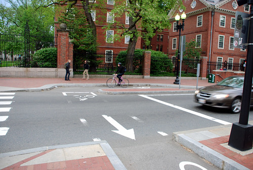
Another example of a bike bay can be found in Cambridge, Massachusetts, right outside Harvard University at the corner of Massachusetts Avenue and Church Street. There a median separates the northbound lanes from southbound, preventing cars from turning left. Rather than forcing left-turning cyclists to cross over 2 lanes of cars and rush to make a sharp turn at the curb cut, it’s better to have them cross perpendicularly, with the crosswalk.
But since the crosswalk is at a major entry gate to Harvard, there’s a lot of pedestrian traffic, making it desirable to separate bikes from both cars and pedestrians. Thus a bike bay, which gives cyclists their own space right next to the crosswalk.
Cambridge bike bay. Photo by the author.
So far there are no bike bays in the DC area, at least as far as I know. But it’s one more potential tool to use at complicated intersections. With more bike lanes and more streetcars on the way, it’s possible this may someday be a useful concept for our region.
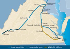
America’s passenger rail network may still be decades behind Europe and Asia, but real progress is being made. Virginia in particular is in the midst of a big expansion in service, with at least 4 major improvement projects:
2009 Lynchburg extension: Starting in 2009, some Northeast Regional Amtrak trains running between DC and Boston began going south to Lynchburg, doubling the Amtrak service from Lynchburg to DC.
Washington-Richmond track improvements: With help from federal stimulus funding, additional tracks are being added on the busy DC-to-Richmond line. The tracks are currently shared with freight trains and are at capacity, so new tracks will allow more (and faster) passenger trains to run.
Norfolk extension: For decades the only Amtrak service to the Norfolk metro area ended at Newport News, well north of the region’s population centers. Starting in just a few days, on December 12, Amtrak will initiate a new route extending from Richmond’s Staples Mill Station (unfortunately not the more convenient Main Street Station) south to downtown Norfolk, with an intermediate stop in Petersburg.
Roanoke extension: Starting in 2018, the Lynchburg-DC-Boston train will be extended to Roanoke, which is currently the largest metro area in Virginia without rail service.
These improvements won’t make Virginia the next Japan, but they are solid investments that mark an important return of rail service to key Virginia cities.
Average Rating: 4.9 out of 5 based on 167 user reviews.