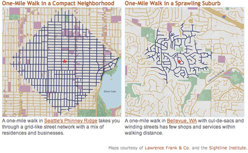
This graphic shows how much ground a pedestrian can cover walking along street sidewalks in a gridded Seattle neighborhood, versus a nearby suburb. Although both maps show a one-mile radius, there are far more destinations within that radius in the gridded neighborhood.
Both maps show neighborhoods that are primarily single-family detached houses: Greenwood, Seattle and Eastgate, Bellevue. But the similarities end there.
In Bellevue trips are indirect and circuitous. Not only are far more residential streets accessible in Seattle, but also more commercial streets (in purple on the map). Both neighborhoods have plenty of parks (shown in green).
Granted, the two maps appear to be at slightly different visual scales, population density is probably higher in Seattle, and pedestrians in Bellevue can probably cut through yards to get places a little faster. But the overall point remains true that far more destinations are within easy walking in Seattle, which – surprise – is why more people walk there.
For the record, the key isn’t a strict rectilinear grid; it’s interconnectivity. Boston’s medieval web of streets is just as good, and maybe even better. The real key variable is the density of intersections, not the straightness of streets.
Average Rating: 4.8 out of 5 based on 165 user reviews.
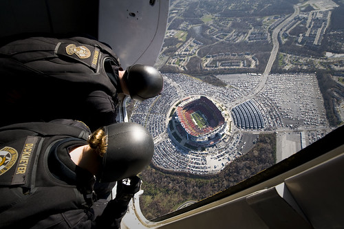
Should Washington’s football team relocate back to Washington? The DC Council is considering replacing RFK with a new stadium, hoping to lure the team back to DC, from Maryland.
It’s a terrible idea.
FedEx Field and its acres of parking. Photo by the US Navy.
Some people will no doubt oppose this idea simply because it’s expensive. But that’s not the problem. Stadiums are cultural amenities that people want, so it’s appropriate for cities to subsidize them sometimes.
This is a terrible idea because football stadiums specifically don’t fit well in cities. NFL stadiums are only used for 8 home games per year, and need large surface parking lots to accommodate the tailgating culture ingrained into football fandom.
The RFK site may not be in the middle of a walkable neighborhood, but surely there are better uses for it than a rarely-used stadium and vast parking lots.
I’m glad we have an NFL team in the region, but let’s leave their stadium in the suburbs.
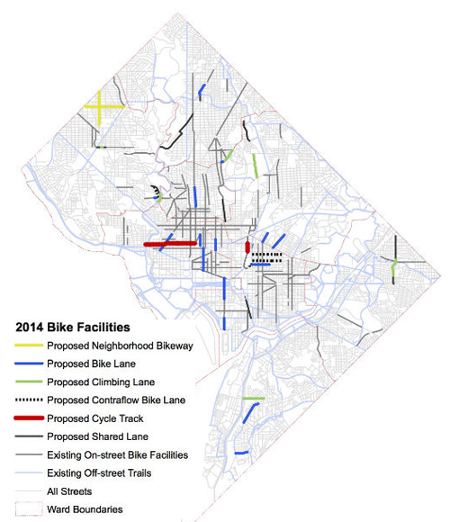
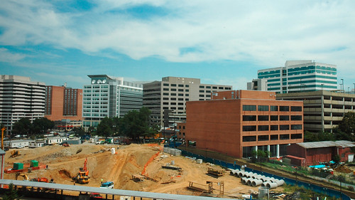
It may be snowing today, but spring is approaching. With construction season therefore around the corner, DDOT has released its list of planned bike projects for 2014.
Map of 2014 bike projects. Image from DDOT.
Most exciting, the highly anticipated M Street and 1st Street NE cycletracks are listed as “ready to go”.
Also ready to go are contraflow bike lanes on G, F, and Eye Streets NE, and standard bike lanes on 13th Street NW, F Street NE, I Street SE, and New Hampshire Avenue NW.
Several other bike lane projects are still in planning, although it doesn’t appear DDOT is actively moving any other cycletrack projects, following completion of M and 1st Street.
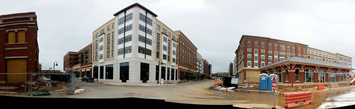
Ellington Boulevard in Downtown Crown, seen from the north.
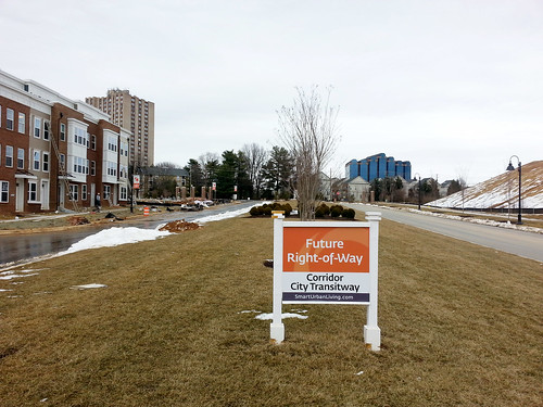
Both neighborhoods are planned around future stations of the Corridor Cities Transitway, which will someday connect a whole string of walkable neighborhoods in upper Montgomery County to Shady Grove Metro station. But with rapid transit service still years away, construction is working from the outside in, focusing first on sections farther from planned transit stations.
Crown
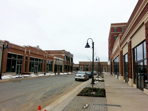
At the Crown development, construction progress is focused on Phase 1, the western half. A mixed-use town center surrounds the corner of Ellington Boulevard and Crown Park Avenue, with blocks of rowhouse neighborhoods to the side.
Ellington Boulevard, seen from the south.
Crown Park Avenue, perpendicular to Ellington Boulevard.
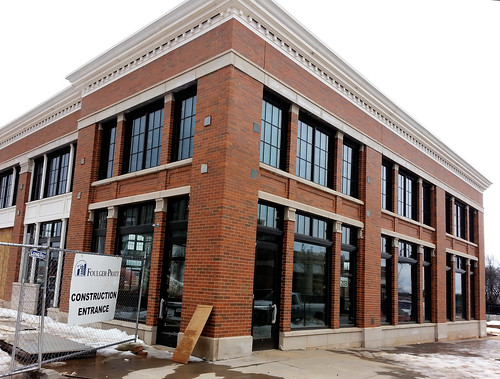
It’s clear that serious work and expense went into the architectural details.
Downtown Crown.
Downtown Crown.
To the east, the rowhouse neighborhoods are taking shape as well.
Rowhouses on Hendrix Avenue.
Decoverly Drive marks the boundary of Phase 1, as well as the future route of the transitway. Crown’s original plans show an even larger town center surrounding the BRT station along Decoverly. But following actual construction, it appears density has been reduced around the station, and rowhouses line the Phase 1 edge instead.
One wonders if Phase 2 will make Crown a truly transit-oriented place, or if transit will merely run through it.
Decoverly Drive.
Watkins Mill Town Center
A few miles to the northwest, adjacent to the Metropolitan Grove MARC station, Watkins Mill Town Center is taking shape.
Watkins Mill Town Center.
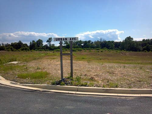
At Watkins Mill, the rowhouses and lower density portions are nearing completion, but the downtown section has yet to begin construction. As a result, a huge field separates the MARC station (and future BRT stop) from the constructed portions of the development.
Urban Avenue, not quite urban yet.
Someday, the Corridor Cities Transitway could make Gaithersburg a second Arlington, a string of walkable communities knit together by transit. Whether that actually happens or not will depend the State of Maryland getting the transitway built, and the City of Gaithersburg insisting on truly transit-oriented places.
Other Dan is completely right. Just to throw my support behind his sensible arguments:
It’s not a pleasant place to be. Good urban parks need active streetscapes around them, with plenty of retail. The old Silver Spring turf worked well because it was at a location people wanted to hang out in. The transit center location on other other hand is surrounded by a parking garage, huge landscaped setbacks, blank walls, and loud, high-traffic highways next to which nobody wants to spend time. The edge conditions are awful. If you just built a park there the result would not be Dupont Circle. It would be this – dreary and dangerous.
There are already parks directly across the street in two directions. One north at 2nd and Colesville, and the other east on the Wayne Avenue side of the Discovery Building. Granted the Discovery park is privately owned and is often fenced off, but getting Discovery to open it up more would be a vastly better and cheaper outcome than taking land next to the transit center. In any event, the other one is open all the time.
Developing the site would actually produce a better park. Since parks should be in pleasant and active locations, good ones should be lined with pleasant buildings. The only way to line this site with pleasant buildings is to construct some pleasant buildings, and put a square in the middle. That’s a fine idea. Incidentally, that’s already the plan.
A park would increase car traffic. Yes, it’s true. The best way to decrease car traffic is to put as much development as close to major transit stations as possible. Displacing the planned development adjacent to the transit center with a park would mean that development happens somewhere else, almost certainly somewhere less transit accessible and by extension more car-dependent.
Buying this valuable land and turning it into a park has absolutely no upside. It would be expensive and it would be a bad park and it would screw over the transportation network. Please, Montgomery County, waste no more time on this terrible, terrible idea.
PS: At Rebuilding Place in the Urban Space, Richard Layman has an extensive discussion of Silver Spring park issues.
Average Rating: 4.9 out of 5 based on 156 user reviews.
The recent snow made for the best sneckdown spotting weather in DC since the term first entered our lexicon. Last week we put out a call for photos of sneckdowns in the wild, and plenty of you responded. Here are some of the best.
17th and Potomac Ave, SE. Photo by Justin Antos.
In the wonky world of urbanism advocacy, sneckdowns have gone viral. The term, referring to places where snow formations show street spaces cars don’t use, first popped up in New York. Since then it’s made headlines in Philadelphia, Chicago, Vancouver, and more.
It’s true that actual engineers shouldn’t design streets solely around piled snow, but certainly sneckdowns are a handy illustration of how we give too much pavement to cars.
Here are more local examples, sent in by readers.
14th St and Independence Ave, SW. Photo by @gregbilling.
M St and Jefferson St, NW. Photo by @gregbilling.
Rhode Island Ave and R St, NW. Photo by @MaryLauran.
Rhode Island Ave and Q St, NW. Photo by @MaryLauran.
4th St, NE. Photo by @TonyTGoodman.
Fairfax Dr and 10th St N, in Arlington. Photo by @guusbosman.
Greenbelt. Photo by msickle.
Thanks to everyone who sent in photos! Keep watching #dcsneckdown on Twitter for more.
There was no mass snowball fight in Dupont Circle yesterday. Instead, Washingtonians celebrated the snow day by filling Dupont with dozens of snowmen and other snow sculptures.
There were two Washington Monuments, a US Capitol, snowman Barack Obama (aka Snowbama), a woman giving birth, a sphinx, and more. Enjoy these photos.
Now that’s we’ve had a big snow in DC, send us pictures of sneckdowns you spot in the wild. You can tweet them with hashtag #dcsneckdown, or email them to us at
sneckdown@beyonddc.com. On Monday, Greater Greater Washington and BeyondDC will publish the best ones.
Sneckdown today in Southeast DC. Photo by Ralph Garboushian.
Sneckdowns are where snow formations show the street spaces cars don’t use.
GGW reader Ralph Garboushian sent us this one already. He describes it:
“Shoveling and plowing patterns in front of my house show how the intersection of Potomac Avenue, E Street & 18th Street SE could be made safer for both pedestrians and motorists. The current design is a disaster – I have seen several accidents at this intersection, including one that sent a car nearly into my front yard and another that took out a historic call box and nearly knocked down a utility pole. In addition, this intersection is right in front of Congressional Cemetery and on the way to the Metro and sees heavy pedestrian traffic.
The intersection’s poor design combined with motorists speeding down Potomac create a hostile and dangerous atmosphere for pedestrians. This intersection desperately needs traffic calming and these plow/shovel patterns illustrate how it could be done.”
DC and the National Park Service (NPS) want feedback on their latest proposals to redesign Franklin Park. Of the 3 options on the table, the one titled “The Diagonal” is by far the best.
“The Diagonal” redesign option for Franklin Square. Image from National Park Service.
This proposal would introduce new paths leading diagonally from the corners of the park into its center. The center itself would feature a larger and better central fountain. Right now the center is poorly used, partly because access to it is circuitous, and the existing fountain is underwhelming (when people notice it at all).
Alone, these are big improvements. But this proposal also makes another strong change: It adds plaza space to the southwest corner of the park, along 14th and Eye Streets.
This proposal rightly accepts the reality of how that small part of Franklin Park is used, and modifies it accordingly.
The southwest corner is effectively a plaza already. With so many people using the bus stops on Eye Street, and entering the park from McPherson Metro station, the intended grass lawn there is more of a dirt patch than an actual lawn. Insisting it remain a lawn would be unrealistic, an eyesore, and would deprive the park’s users of what they really need. This proposal rightly accepts the reality of how that small part of Franklin Park is used, and modifies it accordingly.
Move the statue to 14th/Eye instead of K
Finally, The Diagonal plan moves the existing Commodore Barry statue from the 14th Street side to a more prominent location along K Street. This is a good change, but it would be even better to put the statue directly at the corner of 14th and Eye, to give the new southwest corner plaza a focal point.
I suggested these sort of changes in September. It’s encouraging to see them carried forward. They’re neither radical nor excessive. They retain the park’s existing strengths while tweaking its most important nodes.
The other options
Except for the welcome addition of a playground that’s common to all 3 redesign options, the other 2 alternatives are more conservative.
The option titled “The Center” would focus on cleaning up the existing park elements without making major changes. It would add a small plaza space along K Street, but nothing in the busy southwest portion of the square.
The other option, titled “The Edge”, adds a plaza and 2 small buildings along Eye Street, and makes some improvements to the central fountain. This would be better than the do-almost-nothing “Center” concept, but isn’t as strong as “The Diagonal.”
Send in comments
It’s not every day we get the chance to redesign one of downtown’s main public spaces. It’s important to get this right.
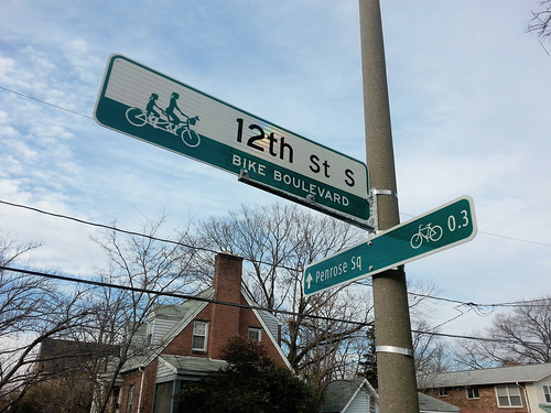
In 2013, Arlington began installing bike boulevards on the streets a block north and south paralleling Columbia Pike. The bike boulevards offer cyclists an alternative to Columbia Pike itself, which will one day have streetcar tracks.
Arlington bike boulevard street sign, with a wayfinding sign to the right.
What’s a bike boulevard
Bike boulevards are slow-speed neighborhood streets where cars and bikes share lanes, but which are optimized for bikes. They’re quiet local roads, usually lined with single-family houses, where there’s such light car traffic that separated lanes for bikes and cars aren’t necessary.
Bike boulevards are common on the west coast, but as far as I know Arlington’s 9th Street South and 12th Street South bike boulevards are the first in the DC region.


